Panyabungan geodata
Panyabungan (North Sumatra) is a seat of a second-order administrative division; located in Indonesia in Asia/Jakarta (GMT+7) time zone. In our database, there are 407 cities with bigger population. Compared to other cities in Indonesia, 97% of cities are located further ↓South; 97.5% of cities are located further →East and 50.6% of cities have higher elevation than Panyabungan. Note1


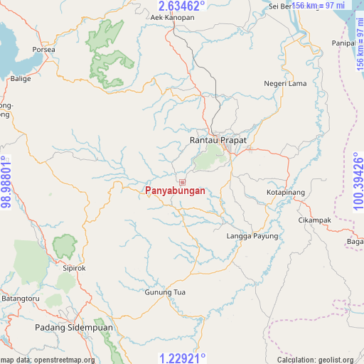
Panyabungan GPS coordinates[2]
1° 55' 55.416" North, 99° 41' 28.068" East
| Map corner | latitude | longitude |
|---|---|---|
| Upper-left | 2.63462°, | 98.98801° |
| Center: | 1.93206°, | 99.69113° |
| Lower-right: | 1.22921°, | 100.39426° |
| Map W x H: | 156.3×156.3 km | = 97.1×97.1mi |
| max Lat: | 5.88969° ⇑3% North |
| Panyabungan: | 1.93206° |
| min Lat: | ⇓97% South -10.934° |
| min Long | Panyabungan | max Long |
| 95.1345° | 99.69113° | 140.9419° |
| W 2.5%⇐ | ⇒97.5% E |
Elevation
Elevation of Panyabungan is 100 m = 328 ft, and this is 129.7 m = 426 ft below average elevation for this country.
| Max E: |
3185 m = 10449 ft | 50.6% |
| Avg. | 229.7 m = 754 ft | |
| Panyabungan | 100 m = 328 ft | |
Min E: |
-1 m = -3 ft | 49.4% |
See also: Indonesia elevation on elevation.city.
Geographical zone
Panyabungan is located in North Torrid zone (between Equator and Tropic of Cancer). Distance of Equator is 214.8 km =133.5 mi to South.| Distance of | km | miles | from Panyabungan |
|---|---|---|---|
| North Pole | 9792.2 | 6084.6 | to North |
| Arctic Circle | 7186.3 | 4465.4 | to North |
| Tropic Cancer | 2391.1 | 1485.8 | to North |
| Equator | 214.8 | 133.5 | to South |


Nearby cities:
15 places around Panyabungan: (largest is in red/bold)
• Aek Kanopan
71.1 km =44.2 mi,  356°
356°
• Bandar
14.7 km =9.1 mi,  26°
26°
• Binanga
58.8 km =36.5 mi,  170°
170°
• Gunung Tua
47.2 km =29.3 mi,  188°
188°
• Kota Pinang
44.8 km =27.8 mi,  95°
95°
• Langgapayung
37.8 km =23.5 mi,  127°
127°
• Padangsidempuan
77.1 km =47.9 mi,  217°
217°
• Rantau Prapat
59.9 km =37.2 mi,  42°
42°
• Rantauprapat
24.5 km =15.2 mi, 40°
• Sampuran
81 km =50.3 mi,  276°
276°
• Sarulla
66.2 km =41.1 mi,  255°
255°
• Sipagimbar
37.2 km =23.1 mi,  252°
252°
• Sipiongot
11.2 km =7 mi,  196°
196°
• Sipirok
59.1 km =36.7 mi,  231°
231°
• Tarutung
81.2 km =50.5 mi, 276°
Sources, notices
• [Note1] Compared only with cities in Indonesia existing in our database
• [Src1] Map data: © OpenStreetMap contributors (CC-BY-SA)
• [Src2] Other city data from geonames.org with taken over terms of usage.
• [Src3] Geographical zone / Annual Mean Temperature by Robert A. Rohde @ Wikipedia
