Ross Carbery geodata
Ross Carbery (Munster) is a populated place; located in Ireland in Europe/Dublin (GMT+1) time zone. With population of 534 people, there are 508 cities with bigger population in this country. Compared to other cities in Ireland, 99.6% of cities are located further ↑North; 89.6% of cities are located further →East and 64.5% of cities have higher elevation than Ross Carbery. Note1


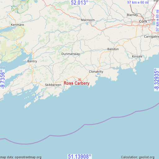
Ross Carbery GPS coordinates[2]
51° 34' 41.304" North, 9° 1' 56.928" West
| Map corner | latitude | longitude |
|---|---|---|
| Upper-left | 52.013°, | -9.7356° |
| Center: | 51.57814°, | -9.03248° |
| Lower-right: | 51.13908°, | -8.32935° |
| Map W x H: | 97.2×97.2 km | = 60.4×60.4mi |
| max Lat: | 55.25° ⇑99.6% North |
| Ross Carbery: | 51.57814° |
| min Lat: | ⇓0.4% South 51.52487° |
| min Long | Ross Carbery | max Long |
| -10.26889° | -9.03248° | -6.04944° |
| W 10.4%⇐ | ⇒89.6% E |
Elevation
Elevation of Ross Carbery is 32 m = 105 ft, and this is 22.5 m = 74 ft below average elevation for this country.
| Max E: |
262 m = 860 ft | 64.5% |
| Avg. | 54.5 m = 179 ft | |
| Ross Carbery | 32 m = 105 ft | |
Min E: |
0 m = 0 ft | 35.5% |
See also: Ireland elevation on elevation.city.
Geographical zone
Ross Carbery is located in North temperate zone (between Tropic of Cancer and the Arctic Circle). Distance of this North polar circle is 1666.2 km =1035.3 mi to North.| Distance of | km | miles | from Ross Carbery |
|---|---|---|---|
| North Pole | 4272.1 | 2654.6 | to North |
| Arctic Circle | 1666.2 | 1035.3 | to North |
| Tropic Cancer | 3129 | 1944.3 | to South |
| Equator | 5735 | 3563.6 | to South |


Nearby cities:
15 places around Ross Carbery: (largest is in red/bold)
• Bandon
27.4 km =17 mi,  46°
46°
• Bantry
31.1 km =19.3 mi,  292°
292°
• Belgooly
41.5 km =25.8 mi,  64°
64°
• Clonakilty
12.2 km =7.6 mi,  65°
65°
• Courtmacsherry
23.4 km =14.5 mi, 74°
• Derry
1.6 km =1 mi,  307°
307°
• Dunmanway
16.5 km =10.3 mi,  339°
339°
• Enniskeane
19.1 km =11.9 mi,  21°
21°
• Innishannon
33.2 km =20.6 mi, 51°
• Killumney
42.1 km =26.2 mi,  38°
38°
• Kinsale
37.5 km =23.3 mi, 67°
• Macroom
36.8 km =22.9 mi,  6°
6°
• Rathard
36.2 km =22.5 mi,  34°
34°
• Schull
36.1 km =22.4 mi,  260°
260°
• Skibbereen
16.5 km =10.3 mi, 259°
Sources, notices
• [Note1] Compared only with cities in Ireland existing in our database
• [Src1] Map data: © OpenStreetMap contributors (CC-BY-SA)
• [Src2] Other city data from geonames.org with taken over terms of usage.
• [Src3] Geographical zone / Annual Mean Temperature by Robert A. Rohde @ Wikipedia
