Macroom geodata
Macroom (Munster) is a populated place; located in Ireland in Europe/Dublin (GMT+1) time zone. With population of 3,169 people, there are 182 cities with bigger population in this country. Compared to other cities in Ireland, 94.5% of cities are located further ↑North; 88.4% of cities are located further →East and 77.8% of cities have lower elevation than Macroom. Note1


Macroom GPS coordinates[2]
51° 54' 23.868" North, 8° 58' 10.848" West
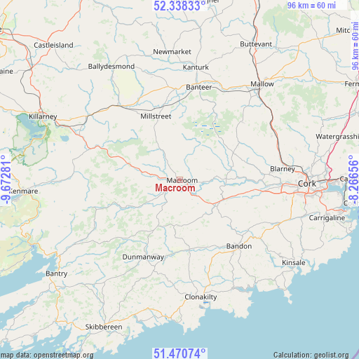
| Map corner | latitude | longitude |
|---|---|---|
| Upper-left | 52.33833°, | -9.67281° |
| Center: | 51.90663°, | -8.96968° |
| Lower-right: | 51.47074°, | -8.26656° |
| Map W x H: | 96.5×96.5 km | = 60×60mi |
| max Lat: | 55.25° ⇑94.5% North |
| Macroom: | 51.90663° |
| min Lat: | ⇓5.5% South 51.52487° |
| min Long | Macroom | max Long |
| -10.26889° | -8.96968° | -6.04944° |
| W 11.6%⇐ | ⇒88.4% E |
Elevation
Elevation of Macroom is 85 m = 279 ft, and this is 30.5 m = 100 ft above average elevation for this country.
| Max E: |
262 m = 860 ft | 22.2% |
| Macroom | 85 m 279 ft | |
| Avg. | 54.5 m = 179 ft | |
Min E: |
0 m = 0 ft | 77.8% |
See also: Ireland elevation on elevation.city.
Geographical zone
Macroom is located in North temperate zone (between Tropic of Cancer and the Arctic Circle). Distance of this North polar circle is 1629.7 km =1012.6 mi to North.| Distance of | km | miles | from Macroom |
|---|---|---|---|
| North Pole | 4235.6 | 2631.9 | to North |
| Arctic Circle | 1629.7 | 1012.6 | to North |
| Tropic Cancer | 3165.6 | 1967 | to South |
| Equator | 5771.5 | 3586.2 | to South |


Nearby cities:
15 places around Macroom: (largest is in red/bold)
• Bandon
23.6 km =14.7 mi,  138°
138°
• Blarney
27.8 km =17.3 mi,  83°
83°
• Courtbrack
23.2 km =14.4 mi,  73°
73°
• Drommahane
29.1 km =18.1 mi,  40°
40°
• Dunmanway
23.4 km =14.5 mi,  205°
205°
• Enniskeane
18.9 km =11.7 mi,  172°
172°
• Grenagh
27.5 km =17.1 mi,  63°
63°
• Innishannon
26.6 km =16.5 mi,  126°
126°
• Kanturk
29.3 km =18.2 mi,  9°
9°
• Killumney
22.4 km =13.9 mi,  99°
99°
• Millstreet
18.1 km =11.2 mi,  339°
339°
• Rathard
17.2 km =10.7 mi,  112°
112°
• Rathmore
25.9 km =16.1 mi,  319°
319°
• Tower
24.9 km =15.5 mi,  85°
85°
• Whitechurch
32.3 km =20.1 mi, 75°
Sources, notices
• [Note1] Compared only with cities in Ireland existing in our database
• [Src1] Map data: © OpenStreetMap contributors (CC-BY-SA)
• [Src2] Other city data from geonames.org with taken over terms of usage.
• [Src3] Geographical zone / Annual Mean Temperature by Robert A. Rohde @ Wikipedia
