Longwood geodata
Longwood (Leinster) is a populated place; located in Ireland in Europe/Dublin (GMT+1) time zone. With population of 1,378 people, there are 286 cities with bigger population in this country. Compared to other cities in Ireland, 70% of cities are located further ↓South; 61.9% of cities are located further ←West and 67% of cities have lower elevation than Longwood. Note1


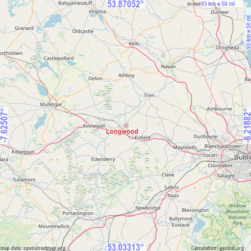
Longwood GPS coordinates[2]
53° 27' 14.004" North, 6° 55' 18.984" West
| Map corner | latitude | longitude |
|---|---|---|
| Upper-left | 53.87052°, | -7.62507° |
| Center: | 53.45389°, | -6.92194° |
| Lower-right: | 53.03313°, | -6.21882° |
| Map W x H: | 93.1×93.1 km | = 57.8×57.8mi |
| max Lat: | 55.25° ⇑30% North |
| Longwood: | 53.45389° |
| min Lat: | ⇓70% South 51.52487° |
| min Long | Longwood | max Long |
| -10.26889° | -6.92194° | -6.04944° |
| W 61.9%⇐ | ⇒38.1% E |
Elevation
Elevation of Longwood is 66 m = 217 ft, and this is 11.5 m = 38 ft above average elevation for this country.
| Max E: |
262 m = 860 ft | 33% |
| Longwood | 66 m 217 ft | |
| Avg. | 54.5 m = 179 ft | |
Min E: |
0 m = 0 ft | 67% |
See also: Ireland elevation on elevation.city.
Geographical zone
Longwood is located in North temperate zone (between Tropic of Cancer and the Arctic Circle). Distance of this North polar circle is 1457.7 km =905.8 mi to North.| Distance of | km | miles | from Longwood |
|---|---|---|---|
| North Pole | 4063.5 | 2524.9 | to North |
| Arctic Circle | 1457.7 | 905.8 | to North |
| Tropic Cancer | 3337.6 | 2073.9 | to South |
| Equator | 5943.5 | 3693.1 | to South |


Nearby cities:
15 places around Longwood: (largest is in red/bold)
• Allenwood Cross Roads
19.3 km =12 mi,  168°
168°
• Athboy
18.8 km =11.7 mi,  1°
1°
• Ballivor
9 km =5.6 mi,  343°
343°
• Blackwood
19.2 km =11.9 mi,  158°
158°
• Derrinturn
12.5 km =7.8 mi,  185°
185°
• Edenderry
15.2 km =9.4 mi,  213°
213°
• Enfield
7.4 km =4.6 mi,  126°
126°
• Johnstown Bridge
7 km =4.3 mi,  143°
143°
• Kilcock
17.6 km =10.9 mi,  109°
109°
• Kildalkey
13 km =8.1 mi,  5°
5°
• Kinnegad
11.8 km =7.3 mi,  269°
269°
• Newtown Trim
15.2 km =9.4 mi,  41°
41°
• Rathwire
15.3 km =9.5 mi,  292°
292°
• Summerhill
12.5 km =7.8 mi,  78°
78°
• Trim
14.2 km =8.8 mi, 37°
Sources, notices
• [Note1] Compared only with cities in Ireland existing in our database
• [Src1] Map data: © OpenStreetMap contributors (CC-BY-SA)
• [Src2] Other city data from geonames.org with taken over terms of usage.
• [Src3] Geographical zone / Annual Mean Temperature by Robert A. Rohde @ Wikipedia
