Carrickmacross geodata
Carrickmacross (Ulster) is a populated place; located in Ireland in Europe/Dublin (GMT+1) time zone. With population of 3,995 people, there are 158 cities with bigger population in this country. Compared to other cities in Ireland, 86.9% of cities are located further ↓South; 68.1% of cities are located further ←West and 58.4% of cities have higher elevation than Carrickmacross. Note1


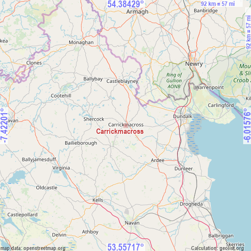
Carrickmacross GPS coordinates[2]
53° 58' 22.008" North, 6° 43' 8.004" West
| Map corner | latitude | longitude |
|---|---|---|
| Upper-left | 54.38429°, | -7.42201° |
| Center: | 53.97278°, | -6.71889° |
| Lower-right: | 53.55717°, | -6.01576° |
| Map W x H: | 92×92 km | = 57.2×57.2mi |
| max Lat: | 55.25° ⇑13.1% North |
| Carrickmacross: | 53.97278° |
| min Lat: | ⇓86.9% South 51.52487° |
| min Long | Carrickmacross | max Long |
| -10.26889° | -6.71889° | -6.04944° |
| W 68.1%⇐ | ⇒31.9% E |
Elevation
Elevation of Carrickmacross is 40 m = 131 ft, and this is 14.5 m = 48 ft below average elevation for this country.
| Max E: |
262 m = 860 ft | 58.4% |
| Avg. | 54.5 m = 179 ft | |
| Carrickmacross | 40 m = 131 ft | |
Min E: |
0 m = 0 ft | 41.6% |
See also: Ireland elevation on elevation.city.
Geographical zone
Carrickmacross is located in North temperate zone (between Tropic of Cancer and the Arctic Circle). Distance of this North polar circle is 1400 km =869.9 mi to North.| Distance of | km | miles | from Carrickmacross |
|---|---|---|---|
| North Pole | 4005.9 | 2489.2 | to North |
| Arctic Circle | 1400 | 869.9 | to North |
| Tropic Cancer | 3395.3 | 2109.7 | to South |
| Equator | 6001.2 | 3729 | to South |


Nearby cities:
15 places around Carrickmacross: (largest is in red/bold)
• Ardee
17.2 km =10.7 mi,  137°
137°
• Bailieborough
17.4 km =10.8 mi,  248°
248°
• Blackrock
23.2 km =14.4 mi,  92°
92°
• Carlanstown
25 km =15.5 mi,  198°
198°
• Castlebellingham
22.9 km =14.2 mi,  110°
110°
• Castleblayney
16 km =9.9 mi,  356°
356°
• Dromiskin
21.3 km =13.2 mi,  104°
104°
• Dundalk
20 km =12.4 mi,  81°
81°
• Dunleer
26.1 km =16.2 mi,  125°
125°
• Kingscourt
9.2 km =5.7 mi,  218°
218°
• Knockbridge
15.2 km =9.4 mi, 89°
• Louth
11.9 km =7.4 mi, 103°
• Mullagh
23.4 km =14.5 mi, 220°
• Shercock
12.2 km =7.6 mi,  284°
284°
• Tallanstown
12.6 km =7.8 mi,  116°
116°
Sources, notices
• [Note1] Compared only with cities in Ireland existing in our database
• [Src1] Map data: © OpenStreetMap contributors (CC-BY-SA)
• [Src2] Other city data from geonames.org with taken over terms of usage.
• [Src3] Geographical zone / Annual Mean Temperature by Robert A. Rohde @ Wikipedia
