Mullagh geodata
Mullagh (Ulster) is a populated place; located in Ireland in Europe/Dublin (GMT+1) time zone. With population of 1,137 people, there are 325 cities with bigger population in this country. Compared to other cities in Ireland, 82.2% of cities are located further ↓South; 61.1% of cities are located further ←West and 90.3% of cities have lower elevation than Mullagh. Note1


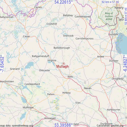
Mullagh GPS coordinates[2]
53° 48' 47.016" North, 6° 57' 5.004" West
| Map corner | latitude | longitude |
|---|---|---|
| Upper-left | 54.22615°, | -7.65452° |
| Center: | 53.81306°, | -6.95139° |
| Lower-right: | 53.39586°, | -6.24827° |
| Map W x H: | 92.3×92.3 km | = 57.4×57.4mi |
| max Lat: | 55.25° ⇑17.8% North |
| Mullagh: | 53.81306° |
| min Lat: | ⇓82.2% South 51.52487° |
| min Long | Mullagh | max Long |
| -10.26889° | -6.95139° | -6.04944° |
| W 61.1%⇐ | ⇒38.9% E |
Elevation
Elevation of Mullagh is 106 m = 348 ft, and this is 51.5 m = 169 ft above average elevation for this country.
| Max E: |
262 m = 860 ft | 9.7% |
| Mullagh | 106 m 348 ft | |
| Avg. | 54.5 m = 179 ft | |
Min E: |
0 m = 0 ft | 90.3% |
See also: Ireland elevation on elevation.city.
Geographical zone
Mullagh is located in North temperate zone (between Tropic of Cancer and the Arctic Circle). Distance of this North polar circle is 1417.7 km =880.9 mi to North.| Distance of | km | miles | from Mullagh |
|---|---|---|---|
| North Pole | 4023.6 | 2500.1 | to North |
| Arctic Circle | 1417.7 | 880.9 | to North |
| Tropic Cancer | 3377.5 | 2098.7 | to South |
| Equator | 5983.5 | 3718 | to South |


Nearby cities:
15 places around Mullagh: (largest is in red/bold)
• Athboy
21.2 km =13.2 mi,  173°
173°
• Bailieborough
11.6 km =7.2 mi,  355°
355°
• Ballyjamesduff
17.5 km =10.9 mi,  289°
289°
• Carlanstown
9.4 km =5.8 mi,  129°
129°
• Carrickmacross
23.4 km =14.5 mi,  40°
40°
• Castlepollard
27.2 km =16.9 mi,  236°
236°
• Clonmellon
17.2 km =10.7 mi,  194°
194°
• Delvin
24.4 km =15.2 mi,  202°
202°
• Kells
10.7 km =6.6 mi,  153°
153°
• Kildalkey
27.2 km =16.9 mi, 173°
• Kingscourt
14.2 km =8.8 mi, 42°
• Navan
25.2 km =15.7 mi,  135°
135°
• Oldcastle
14.8 km =9.2 mi,  249°
249°
• Shercock
21.1 km =13.1 mi,  9°
9°
• Virginia
8.5 km =5.3 mi, 285°
Sources, notices
• [Note1] Compared only with cities in Ireland existing in our database
• [Src1] Map data: © OpenStreetMap contributors (CC-BY-SA)
• [Src2] Other city data from geonames.org with taken over terms of usage.
• [Src3] Geographical zone / Annual Mean Temperature by Robert A. Rohde @ Wikipedia
