Turuvekere geodata
Turuvekere (Karnataka) is a populated place; located in India in Asia/Kolkata (GMT+5.5) time zone. With population of 14,115 people, there are 2551 cities with bigger population in this country. Compared to other cities in India, 85.4% of cities are located further ↑North; 66.6% of cities are located further →East and 94.2% of cities have lower elevation than Turuvekere. Note1


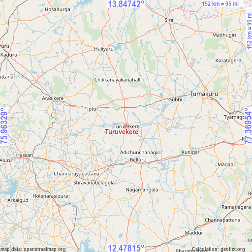
Turuvekere GPS coordinates[2]
13° 9' 49.464" North, 76° 39' 59.076" East
| Map corner | latitude | longitude |
|---|---|---|
| Upper-left | 13.84742°, | 75.96329° |
| Center: | 13.16374°, | 76.66641° |
| Lower-right: | 12.47815°, | 77.36954° |
| Map W x H: | 152.2×152.3 km | = 94.6×94.6mi |
| max Lat: | 34.9274° ⇑85.4% North |
| Turuvekere: | 13.16374° |
| min Lat: | ⇓14.6% South 8.09008° |
| min Long | Turuvekere | max Long |
| 68.82655° | 76.66641° | 96.81° |
| W 33.4%⇐ | ⇒66.6% E |
Elevation
Elevation of Turuvekere is 808 m = 2651 ft, and this is 512.4 m = 1681 ft above average elevation for this country.
| Max E: |
3681 m = 12077 ft | 5.8% |
| Turuvekere | 808 m 2651 ft | |
| Avg. | 295.6 m = 970 ft | |
Min E: |
1 m = 3 ft | 94.2% |
See also: India elevation on elevation.city.
Geographical zone
Turuvekere is located in North Torrid zone (between Equator and Tropic of Cancer). Distance of this Northern Tropic circle is 1142.2 km =709.7 mi to North.| Distance of | km | miles | from Turuvekere |
|---|---|---|---|
| North Pole | 8543.4 | 5308.6 | to North |
| Arctic Circle | 5937.5 | 3689.4 | to North |
| Tropic Cancer | 1142.2 | 709.7 | to North |
| Equator | 1463.7 | 909.5 | to South |


Nearby cities:
15 places around Turuvekere: (largest is in red/bold)
• Arsikere
47.4 km =29.5 mi,  290°
290°
• Bellūru
21.5 km =13.4 mi,  160°
160°
• Bānāvar
61 km =37.9 mi,  296°
296°
• Channarāyapatna
41.6 km =25.8 mi,  226°
226°
• Chiknāyakanhalli
28.5 km =17.7 mi,  349°
349°
• Gubbi
34 km =21.1 mi,  60°
60°
• Hassan
64.2 km =39.9 mi,  254°
254°
• Hole Narsipur
62.1 km =38.6 mi, 227°
• Krishnarājpet
58.6 km =36.4 mi,  199°
199°
• Kunigal
41.9 km =26 mi,  111°
111°
• Melukote
55.8 km =34.7 mi,  181°
181°
• Nāgamangala
39.5 km =24.5 mi,  165°
165°
• Srāvana Belgola
39.1 km =24.3 mi,  209°
209°
• Tiptūr
22.9 km =14.2 mi, 296°
• Tumkūr
51.1 km =31.8 mi,  67°
67°
Sources, notices
• [Note1] Compared only with cities in India existing in our database
• [Src1] Map data: © OpenStreetMap contributors (CC-BY-SA)
• [Src2] Other city data from geonames.org with taken over terms of usage.
• [Src3] Geographical zone / Annual Mean Temperature by Robert A. Rohde @ Wikipedia
