Nāgamangala geodata
Nāgamangala (Karnataka) is a populated place; located in India in Asia/Kolkata (GMT+5.5) time zone. With population of 16,760 people, there are 2304 cities with bigger population in this country. Compared to other cities in India, 87.3% of cities are located further ↑North; 65.6% of cities are located further →East and 93.8% of cities have lower elevation than Nāgamangala. Note1


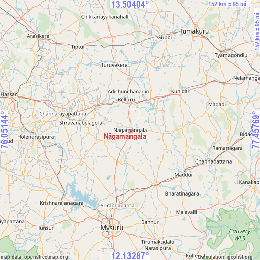
Nāgamangala GPS coordinates[2]
12° 49' 9.804" North, 76° 45' 16.416" East
| Map corner | latitude | longitude |
|---|---|---|
| Upper-left | 13.50404°, | 76.05144° |
| Center: | 12.81939°, | 76.75456° |
| Lower-right: | 12.13287°, | 77.45769° |
| Map W x H: | 152.5×152.5 km | = 94.8×94.8mi |
| max Lat: | 34.9274° ⇑87.3% North |
| Nāgamangala: | 12.81939° |
| min Lat: | ⇓12.7% South 8.09008° |
| min Long | Nāgamangala | max Long |
| 68.82655° | 76.75456° | 96.81° |
| W 34.4%⇐ | ⇒65.6% E |
Elevation
Elevation of Nāgamangala is 790 m = 2592 ft, and this is 494.4 m = 1622 ft above average elevation for this country.
| Max E: |
3681 m = 12077 ft | 6.2% |
| Nāgamangala | 790 m 2592 ft | |
| Avg. | 295.6 m = 970 ft | |
Min E: |
1 m = 3 ft | 93.8% |
See also: India elevation on elevation.city.
Geographical zone
Nāgamangala is located in North Torrid zone (between Equator and Tropic of Cancer). Distance of this Northern Tropic circle is 1180.5 km =733.5 mi to North.| Distance of | km | miles | from Nāgamangala |
|---|---|---|---|
| North Pole | 8581.7 | 5332.4 | to North |
| Arctic Circle | 5975.8 | 3713.2 | to North |
| Tropic Cancer | 1180.5 | 733.5 | to North |
| Equator | 1425.4 | 885.7 | to South |


Nearby cities:
15 places around Nāgamangala: (largest is in red/bold)
• Bannūr
55.3 km =34.4 mi,  167°
167°
• Bellūru
18.2 km =11.3 mi,  352°
352°
• Channapatna
52.5 km =32.6 mi,  110°
110°
• Channarāyapatna
40.9 km =25.4 mi,  283°
283°
• French Rocks
36.5 km =22.7 mi,  193°
193°
• Hole Narsipur
55.6 km =34.5 mi,  266°
266°
• Krishnarājpet
33.6 km =20.9 mi,  239°
239°
• Kunigal
37.1 km =23.1 mi,  52°
52°
• Maddūr
40.9 km =25.4 mi,  130°
130°
• Mandya
36.5 km =22.7 mi,  154°
154°
• Melukote
20.9 km =13 mi,  213°
213°
• Māgadi
53.1 km =33 mi,  73°
73°
• Shrīrangapattana
44.8 km =27.8 mi, 189°
• Srāvana Belgola
29.1 km =18.1 mi, 278°
• Turuvekere
39.5 km =24.5 mi, 345°
Sources, notices
• [Note1] Compared only with cities in India existing in our database
• [Src1] Map data: © OpenStreetMap contributors (CC-BY-SA)
• [Src2] Other city data from geonames.org with taken over terms of usage.
• [Src3] Geographical zone / Annual Mean Temperature by Robert A. Rohde @ Wikipedia
