Tohāna geodata
Tohāna (Haryana) is a populated place; located in India in Asia/Kolkata (GMT+5.5) time zone. With population of 59,749 people, there are 736 cities with bigger population in this country. Compared to other cities in India, 91.9% of cities are located further ↓South; 74.6% of cities are located further →East and 55.8% of cities have lower elevation than Tohāna. Note1


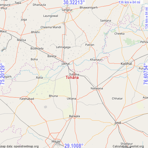
Tohāna GPS coordinates[2]
29° 42' 47.952" North, 75° 54' 15.876" East
| Map corner | latitude | longitude |
|---|---|---|
| Upper-left | 30.32213°, | 75.20129° |
| Center: | 29.71332°, | 75.90441° |
| Lower-right: | 29.1008°, | 76.60754° |
| Map W x H: | 135.8×135.8 km | = 84.4×84.4mi |
| max Lat: | 34.9274° ⇑8.1% North |
| Tohāna: | 29.71332° |
| min Lat: | ⇓91.9% South 8.09008° |
| min Long | Tohāna | max Long |
| 68.82655° | 75.90441° | 96.81° |
| W 25.4%⇐ | ⇒74.6% E |
Elevation
Elevation of Tohāna is 229 m = 751 ft, and this is 66.6 m = 219 ft below average elevation for this country.
| Max E: |
3681 m = 12077 ft | 44.2% |
| Avg. | 295.6 m = 970 ft | |
| Tohāna | 229 m = 751 ft | |
Min E: |
1 m = 3 ft | 55.8% |
See also: Tohāna elevation on elevation.city.
Geographical zone
Tohāna is located in North temperate zone (between Tropic of Cancer and the Arctic Circle). Distance of this Northern Tropic circle is 697.9 km =433.7 mi to South.| Distance of | km | miles | from Tohāna |
|---|---|---|---|
| North Pole | 6703.3 | 4165.2 | to North |
| Arctic Circle | 4097.4 | 2546 | to North |
| Tropic Cancer | 697.9 | 433.7 | to South |
| Equator | 3303.8 | 2052.9 | to South |


Nearby cities:
15 places around Tohāna: (largest is in red/bold)
• Akālgarh
12 km =7.5 mi,  353°
353°
• Bara Uchāna
38 km =23.6 mi,  135°
135°
• Barwāla
38.5 km =23.9 mi,  179°
179°
• Bhīkhi
52.4 km =32.6 mi,  317°
317°
• Budhlāda
40.7 km =25.3 mi,  305°
305°
• Dirba
40.9 km =25.4 mi,  12°
12°
• Fatehābād
48.7 km =30.3 mi,  243°
243°
• Gorakhpur
37.1 km =23.1 mi,  217°
217°
• Inda Chhoi
13.7 km =8.5 mi,  233°
233°
• Jākhal
12.1 km =7.5 mi, 319°
• Kaithal
48.8 km =30.3 mi,  78°
78°
• Narwāna
24.3 km =15.1 mi,  121°
121°
• Ratia
31.7 km =19.7 mi,  265°
265°
• Sunām
47.3 km =29.4 mi, 347°
• Uklāna
22.6 km =14 mi,  186°
186°
Sources, notices
• [Note1] Compared only with cities in India existing in our database
• [Src1] Map data: © OpenStreetMap contributors (CC-BY-SA)
• [Src2] Other city data from geonames.org with taken over terms of usage.
• [Src3] Geographical zone / Annual Mean Temperature by Robert A. Rohde @ Wikipedia
