Tendūkheda geodata
Tendūkheda (Madhya Pradesh) is a populated place; located in India in Asia/Kolkata (GMT+5.5) time zone. With population of 12,698 people, there are 2680 cities with bigger population in this country. Compared to other cities in India, 54.2% of cities are located further ↓South; 64.1% of cities are located further ←West and 75.9% of cities have lower elevation than Tendūkheda. Note1


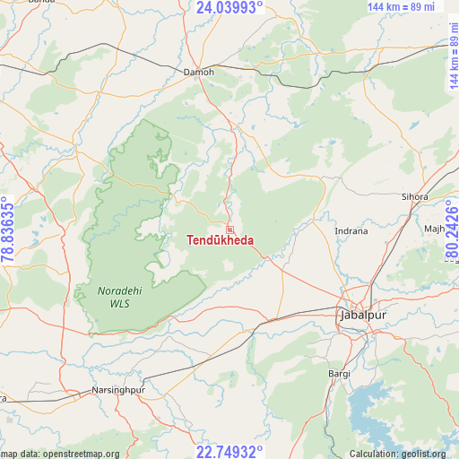
Tendūkheda GPS coordinates[2]
23° 23' 46.32" North, 79° 32' 22.092" East
| Map corner | latitude | longitude |
|---|---|---|
| Upper-left | 24.03993°, | 78.83635° |
| Center: | 23.3962°, | 79.53947° |
| Lower-right: | 22.74932°, | 80.2426° |
| Map W x H: | 143.5×143.5 km | = 89.2×89.2mi |
| max Lat: | 34.9274° ⇑45.8% North |
| Tendūkheda: | 23.3962° |
| min Lat: | ⇓54.2% South 8.09008° |
| min Long | Tendūkheda | max Long |
| 68.82655° | 79.53947° | 96.81° |
| W 64.1%⇐ | ⇒35.9% E |
Elevation
Elevation of Tendūkheda is 398 m = 1306 ft, and this is 102.4 m = 336 ft above average elevation for this country.
| Max E: |
3681 m = 12077 ft | 24.1% |
| Tendūkheda | 398 m 1306 ft | |
| Avg. | 295.6 m = 970 ft | |
Min E: |
1 m = 3 ft | 75.9% |
See also: India elevation on elevation.city.
Geographical zone
Tendūkheda is located in North Torrid zone (between Equator and Tropic of Cancer). Distance of this Northern Tropic circle is 4.5 km =2.8 mi to North.| Distance of | km | miles | from Tendūkheda |
|---|---|---|---|
| North Pole | 7405.6 | 4601.6 | to North |
| Arctic Circle | 4799.8 | 2982.5 | to North |
| Tropic Cancer | 4.5 | 2.8 | to North |
| Equator | 2601.4 | 1616.4 | to South |


Nearby cities:
15 places around Tendūkheda: (largest is in red/bold)
• Bargi
56.6 km =35.2 mi,  142°
142°
• Damoh
49.6 km =30.8 mi,  348°
348°
• Deori Khās
53.4 km =33.2 mi,  269°
269°
• Garhākota
58.7 km =36.5 mi,  316°
316°
• Hindoria
56.5 km =35.1 mi,  3°
3°
• Jabalpur
49.1 km =30.5 mi,  121°
121°
• Kaimori
20.9 km =13 mi,  93°
93°
• Katangi
26.7 km =16.6 mi,  79°
79°
• Khamaria
39.6 km =24.6 mi, 118°
• Majholi
40.9 km =25.4 mi,  73°
73°
• Panāgar
48.1 km =29.9 mi,  104°
104°
• Pātan
19.6 km =12.2 mi,  128°
128°
• Rehli
55.5 km =34.5 mi,  298°
298°
• Shāhpura
31.5 km =19.6 mi,  156°
156°
• Sihorā
58.5 km =36.4 mi, 80°
Sources, notices
• [Note1] Compared only with cities in India existing in our database
• [Src1] Map data: © OpenStreetMap contributors (CC-BY-SA)
• [Src2] Other city data from geonames.org with taken over terms of usage.
• [Src3] Geographical zone / Annual Mean Temperature by Robert A. Rohde @ Wikipedia
