Khamaria geodata
Khamaria (Madhya Pradesh) is a abandoned populated place; located in India in Asia/Kolkata (GMT+5.5) time zone. With population of 15,019 people, there are 2461 cities with bigger population in this country. Compared to other cities in India, 53.2% of cities are located further ↓South; 67% of cities are located further ←West and 74.8% of cities have lower elevation than Khamaria. Note1


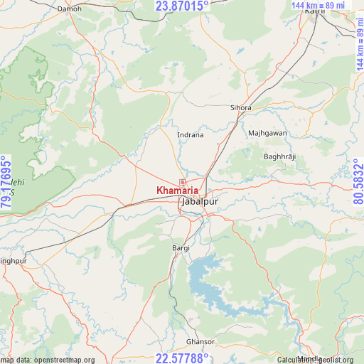
Khamaria GPS coordinates[2]
23° 13' 32.088" North, 79° 52' 48.252" East
| Map corner | latitude | longitude |
|---|---|---|
| Upper-left | 23.87015°, | 79.17695° |
| Center: | 23.22558°, | 79.88007° |
| Lower-right: | 22.57788°, | 80.5832° |
| Map W x H: | 143.7×143.7 km | = 89.3×89.3mi |
| max Lat: | 34.9274° ⇑46.8% North |
| Khamaria: | 23.22558° |
| min Lat: | ⇓53.2% South 8.09008° |
| min Long | Khamaria | max Long |
| 68.82655° | 79.88007° | 96.81° |
| W 67%⇐ | ⇒33% E |
Elevation
Elevation of Khamaria is 383 m = 1257 ft, and this is 87.4 m = 287 ft above average elevation for this country.
| Max E: |
3681 m = 12077 ft | 25.2% |
| Khamaria | 383 m 1257 ft | |
| Avg. | 295.6 m = 970 ft | |
Min E: |
1 m = 3 ft | 74.8% |
See also: India elevation on elevation.city.
Geographical zone
Khamaria is located in North Torrid zone (between Equator and Tropic of Cancer). Distance of this Northern Tropic circle is 23.5 km =14.6 mi to North.| Distance of | km | miles | from Khamaria |
|---|---|---|---|
| North Pole | 7424.6 | 4613.4 | to North |
| Arctic Circle | 4818.7 | 2994.2 | to North |
| Tropic Cancer | 23.5 | 14.6 | to North |
| Equator | 2582.4 | 1604.6 | to South |


Nearby cities:
15 places around Khamaria: (largest is in red/bold)
• Barela
22.6 km =14 mi,  129°
129°
• Bargi
26 km =16.2 mi,  181°
181°
• Damoh
81 km =50.3 mi,  326°
326°
• Ghansor
63.3 km =39.3 mi,  173°
173°
• Jabalpur
9.7 km =6 mi, 132°
• Kaimori
22.5 km =14 mi,  321°
321°
• Katangi
25.5 km =15.8 mi,  340°
340°
• Lakhnādon
75.2 km =46.7 mi,  202°
202°
• Majholi
31 km =19.3 mi,  8°
8°
• Narsimhapur
77.6 km =48.2 mi,  246°
246°
• Panāgar
13.5 km =8.4 mi,  60°
60°
• Pātan
20.6 km =12.8 mi,  289°
289°
• Shāhpura
24.2 km =15 mi, 245°
• Sihorā
37 km =23 mi,  38°
38°
• Tendūkheda
39.6 km =24.6 mi,  298°
298°
Sources, notices
• [Note1] Compared only with cities in India existing in our database
• [Src1] Map data: © OpenStreetMap contributors (CC-BY-SA)
• [Src2] Other city data from geonames.org with taken over terms of usage.
• [Src3] Geographical zone / Annual Mean Temperature by Robert A. Rohde @ Wikipedia
