Tarikere geodata
Tarikere (Karnataka) is a populated place; located in India in Asia/Kolkata (GMT+5.5) time zone. With population of 37,848 people, there are 1164 cities with bigger population in this country. Compared to other cities in India, 83.8% of cities are located further ↑North; 75.5% of cities are located further →East and 92.1% of cities have lower elevation than Tarikere. Note1


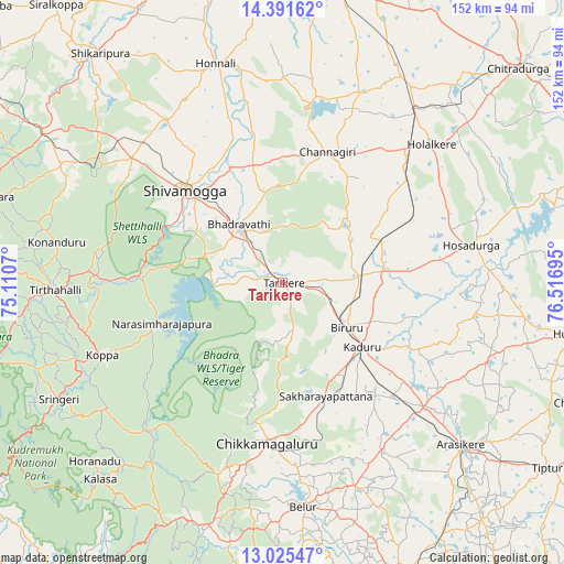
Tarikere GPS coordinates[2]
13° 42' 34.344" North, 75° 48' 49.752" East
| Map corner | latitude | longitude |
|---|---|---|
| Upper-left | 14.39162°, | 75.1107° |
| Center: | 13.70954°, | 75.81382° |
| Lower-right: | 13.02547°, | 76.51695° |
| Map W x H: | 151.9×151.9 km | = 94.4×94.4mi |
| max Lat: | 34.9274° ⇑83.8% North |
| Tarikere: | 13.70954° |
| min Lat: | ⇓16.2% South 8.09008° |
| min Long | Tarikere | max Long |
| 68.82655° | 75.81382° | 96.81° |
| W 24.5%⇐ | ⇒75.5% E |
Elevation
Elevation of Tarikere is 685 m = 2247 ft, and this is 389.4 m = 1278 ft above average elevation for this country.
| Max E: |
3681 m = 12077 ft | 7.9% |
| Tarikere | 685 m 2247 ft | |
| Avg. | 295.6 m = 970 ft | |
Min E: |
1 m = 3 ft | 92.1% |
See also: India elevation on elevation.city.
Geographical zone
Tarikere is located in North Torrid zone (between Equator and Tropic of Cancer). Distance of this Northern Tropic circle is 1081.6 km =672.1 mi to North.| Distance of | km | miles | from Tarikere |
|---|---|---|---|
| North Pole | 8482.7 | 5270.9 | to North |
| Arctic Circle | 5876.8 | 3651.7 | to North |
| Tropic Cancer | 1081.6 | 672.1 | to North |
| Equator | 1524.4 | 947.2 | to South |


Nearby cities:
15 places around Tarikere: (largest is in red/bold)
• Ajjampur
20.9 km =13 mi,  84°
84°
• Belūr
60.7 km =37.7 mi,  174°
174°
• Bhadrāvati
19.4 km =12.1 mi,  322°
322°
• Birūr
21.1 km =13.1 mi,  126°
126°
• Bānāvar
50.3 km =31.3 mi, 131°
• Channagiri
37 km =23 mi,  19°
19°
• Chikmagalūr
43.3 km =26.9 mi,  185°
185°
• Holalkere
54.6 km =33.9 mi,  47°
47°
• Hosdurga
51.7 km =32.1 mi, 79°
• Kadūr
27.6 km =17.1 mi, 129°
• Koppa
52.6 km =32.7 mi,  247°
247°
• Kumsi
58.9 km =36.6 mi,  310°
310°
• Narasimharājapura
34.4 km =21.4 mi, 251°
• Nyāmti
55.1 km =34.2 mi,  332°
332°
• Shimoga
36.3 km =22.6 mi, 312°
Sources, notices
• [Note1] Compared only with cities in India existing in our database
• [Src1] Map data: © OpenStreetMap contributors (CC-BY-SA)
• [Src2] Other city data from geonames.org with taken over terms of usage.
• [Src3] Geographical zone / Annual Mean Temperature by Robert A. Rohde @ Wikipedia
