Holalkere geodata
Holalkere (Karnataka) is a populated place; located in India in Asia/Kolkata (GMT+5.5) time zone. With population of 15,480 people, there are 2414 cities with bigger population in this country. Compared to other cities in India, 83.3% of cities are located further ↑North; 71.8% of cities are located further →East and 92.5% of cities have lower elevation than Holalkere. Note1


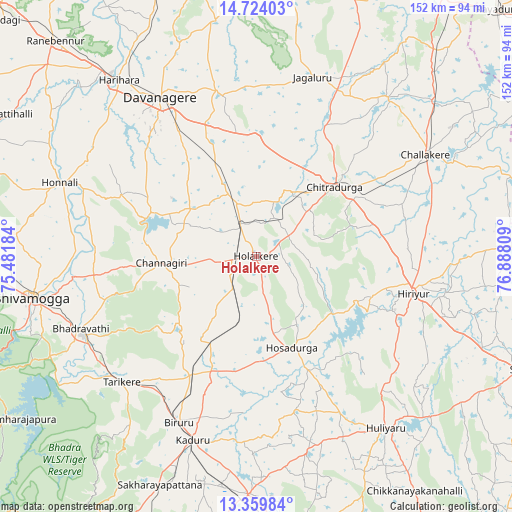
Holalkere GPS coordinates[2]
14° 2' 34.62" North, 76° 11' 5.856" East
| Map corner | latitude | longitude |
|---|---|---|
| Upper-left | 14.72403°, | 75.48184° |
| Center: | 14.04295°, | 76.18496° |
| Lower-right: | 13.35984°, | 76.88809° |
| Map W x H: | 151.7×151.7 km | = 94.3×94.3mi |
| max Lat: | 34.9274° ⇑83.3% North |
| Holalkere: | 14.04295° |
| min Lat: | ⇓16.7% South 8.09008° |
| min Long | Holalkere | max Long |
| 68.82655° | 76.18496° | 96.81° |
| W 28.2%⇐ | ⇒71.8% E |
Elevation
Elevation of Holalkere is 707 m = 2320 ft, and this is 411.4 m = 1350 ft above average elevation for this country.
| Max E: |
3681 m = 12077 ft | 7.5% |
| Holalkere | 707 m 2320 ft | |
| Avg. | 295.6 m = 970 ft | |
Min E: |
1 m = 3 ft | 92.5% |
See also: India elevation on elevation.city.
Geographical zone
Holalkere is located in North Torrid zone (between Equator and Tropic of Cancer). Distance of this Northern Tropic circle is 1044.5 km =649 mi to North.| Distance of | km | miles | from Holalkere |
|---|---|---|---|
| North Pole | 8445.6 | 5247.9 | to North |
| Arctic Circle | 5839.7 | 3628.6 | to North |
| Tropic Cancer | 1044.5 | 649 | to North |
| Equator | 1561.4 | 970.2 | to South |


Nearby cities:
15 places around Holalkere: (largest is in red/bold)
• Ajjampur
40 km =24.9 mi,  208°
208°
• Bhadrāvati
56.1 km =34.9 mi,  247°
247°
• Birūr
54.6 km =33.9 mi,  204°
204°
• Challakere
58.9 km =36.6 mi,  58°
58°
• Channagiri
28 km =17.4 mi,  265°
265°
• Chitradurga
30.6 km =19 mi,  49°
49°
• Davangere
54.7 km =34 mi,  329°
329°
• Harihar
66.2 km =41.1 mi,  322°
322°
• Hiriyūr
47.9 km =29.8 mi,  103°
103°
• Honnāli
62.2 km =38.6 mi,  290°
290°
• Hosdurga
29.4 km =18.3 mi,  158°
158°
• Jagalūr
55.5 km =34.5 mi,  17°
17°
• Kadūr
57.6 km =35.8 mi, 198°
• Māyakonda
29.5 km =18.3 mi,  338°
338°
• Tarikere
54.6 km =33.9 mi,  227°
227°
Sources, notices
• [Note1] Compared only with cities in India existing in our database
• [Src1] Map data: © OpenStreetMap contributors (CC-BY-SA)
• [Src2] Other city data from geonames.org with taken over terms of usage.
• [Src3] Geographical zone / Annual Mean Temperature by Robert A. Rohde @ Wikipedia
