Sri Dūngargarh geodata
Sri Dūngargarh (Rajasthan) is a populated place; located in India in Asia/Kolkata (GMT+5.5) time zone. With population of 48,036 people, there are 914 cities with bigger population in this country. Compared to other cities in India, 84.9% of cities are located further ↓South; 89.3% of cities are located further →East and 61.5% of cities have lower elevation than Sri Dūngargarh. Note1


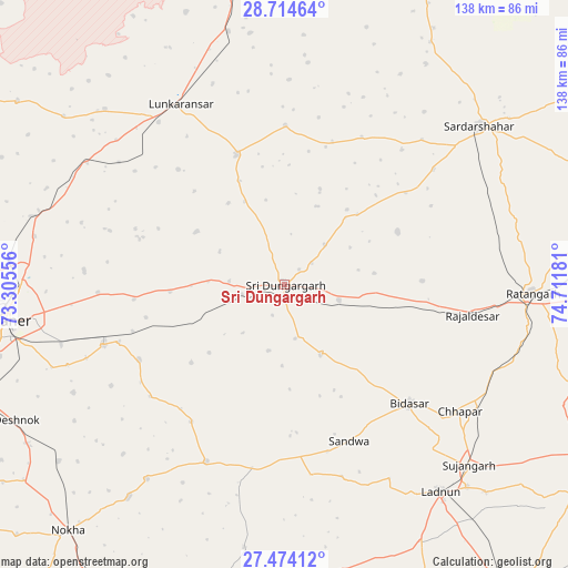
Sri Dūngargarh GPS coordinates[2]
28° 5' 46.212" North, 74° 0' 31.248" East
| Map corner | latitude | longitude |
|---|---|---|
| Upper-left | 28.71464°, | 73.30556° |
| Center: | 28.09617°, | 74.00868° |
| Lower-right: | 27.47412°, | 74.71181° |
| Map W x H: | 137.9×137.9 km | = 85.7×85.7mi |
| max Lat: | 34.9274° ⇑15.1% North |
| Sri Dūngargarh: | 28.09617° |
| min Lat: | ⇓84.9% South 8.09008° |
| min Long | Sri Dūngargarh | max Long |
| 68.82655° | 74.00868° | 96.81° |
| W 10.7%⇐ | ⇒89.3% E |
Elevation
Elevation of Sri Dūngargarh is 262 m = 860 ft, and this is 33.6 m = 110 ft below average elevation for this country.
| Max E: |
3681 m = 12077 ft | 38.5% |
| Avg. | 295.6 m = 970 ft | |
| Sri Dūngargarh | 262 m = 860 ft | |
Min E: |
1 m = 3 ft | 61.5% |
See also: Sri Dūngargarh elevation on elevation.city.
Geographical zone
Sri Dūngargarh is located in North temperate zone (between Tropic of Cancer and the Arctic Circle). Distance of this Northern Tropic circle is 518.1 km =321.9 mi to South.| Distance of | km | miles | from Sri Dūngargarh |
|---|---|---|---|
| North Pole | 6883.1 | 4277 | to North |
| Arctic Circle | 4277.2 | 2657.7 | to North |
| Tropic Cancer | 518.1 | 321.9 | to South |
| Equator | 3124 | 1941.2 | to South |


Nearby cities:
15 places around Sri Dūngargarh: (largest is in red/bold)
• Bhādāsar
36.7 km =22.8 mi,  48°
48°
• Bīkaner
68.6 km =42.6 mi,  262°
262°
• Chhāpar
52.3 km =32.5 mi,  126°
126°
• Chūru
96.7 km =60.1 mi,  76°
76°
• Deshnoke
73.3 km =45.5 mi,  243°
243°
• Dīdwāna
95.3 km =59.2 mi,  144°
144°
• Fatehpur
93.7 km =58.2 mi,  96°
96°
• Lādnūn
62.5 km =38.8 mi, 142°
• Meethari Marwar
88.2 km =54.8 mi, 130°
• Napāsar
46.6 km =29 mi,  251°
251°
• Nokha
79.5 km =49.4 mi,  221°
221°
• Ratangarh
59.8 km =37.2 mi,  91°
91°
• Rājaldesar
46.3 km =28.8 mi, 99°
• Sardārshahr
60.8 km =37.8 mi, 50°
• Sūjāngarh
63 km =39.1 mi, 134°
Sources, notices
• [Note1] Compared only with cities in India existing in our database
• [Src1] Map data: © OpenStreetMap contributors (CC-BY-SA)
• [Src2] Other city data from geonames.org with taken over terms of usage.
• [Src3] Geographical zone / Annual Mean Temperature by Robert A. Rohde @ Wikipedia
