Sindhnūr geodata
Sindhnūr (Karnataka) is a populated place; located in India in Asia/Kolkata (GMT+5.5) time zone. With population of 68,793 people, there are 627 cities with bigger population in this country. Compared to other cities in India, 78.7% of cities are located further ↑North; 65.6% of cities are located further →East and 75.7% of cities have lower elevation than Sindhnūr. Note1


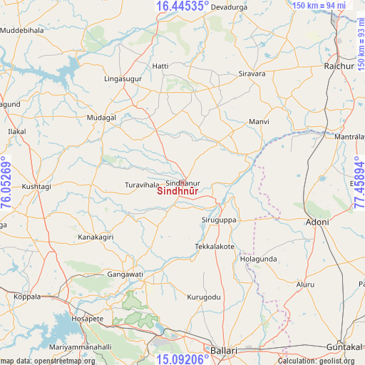
Sindhnūr GPS coordinates[2]
15° 46' 11.388" North, 76° 45' 20.916" East
| Map corner | latitude | longitude |
|---|---|---|
| Upper-left | 16.44535°, | 76.05269° |
| Center: | 15.76983°, | 76.75581° |
| Lower-right: | 15.09206°, | 77.45894° |
| Map W x H: | 150.5×150.5 km | = 93.5×93.5mi |
| max Lat: | 34.9274° ⇑78.7% North |
| Sindhnūr: | 15.76983° |
| min Lat: | ⇓21.3% South 8.09008° |
| min Long | Sindhnūr | max Long |
| 68.82655° | 76.75581° | 96.81° |
| W 34.4%⇐ | ⇒65.6% E |
Elevation
Elevation of Sindhnūr is 395 m = 1296 ft, and this is 99.4 m = 326 ft above average elevation for this country.
| Max E: |
3681 m = 12077 ft | 24.3% |
| Sindhnūr | 395 m 1296 ft | |
| Avg. | 295.6 m = 970 ft | |
Min E: |
1 m = 3 ft | 75.7% |
See also: Sindhnūr elevation on elevation.city.
Geographical zone
Sindhnūr is located in North Torrid zone (between Equator and Tropic of Cancer). Distance of this Northern Tropic circle is 852.5 km =529.7 mi to North.| Distance of | km | miles | from Sindhnūr |
|---|---|---|---|
| North Pole | 8253.6 | 5128.5 | to North |
| Arctic Circle | 5647.7 | 3509.3 | to North |
| Tropic Cancer | 852.5 | 529.7 | to North |
| Equator | 1753.4 | 1089.5 | to South |


Nearby cities:
15 places around Sindhnūr: (largest is in red/bold)
• Bellary
72.1 km =44.8 mi,  165°
165°
• Gangāwati
44.8 km =27.8 mi,  212°
212°
• Hampi
57.8 km =35.9 mi, 213°
• Hospet
68.2 km =42.4 mi,  215°
215°
• Ilkal
71.9 km =44.7 mi,  287°
287°
• Kampli
43.7 km =27.2 mi,  202°
202°
• Kosigi
53.1 km =33 mi,  79°
79°
• Kushtagi
60.4 km =37.5 mi,  268°
268°
• Lingsugūr
50 km =31.1 mi,  329°
329°
• Mudgal
43 km =26.7 mi,  308°
308°
• Munirābād
68 km =42.3 mi, 221°
• Mānvi
40 km =24.9 mi,  51°
51°
• Siruguppa
21.3 km =13.2 mi,  136°
136°
• Tekkalakote
29.2 km =18.1 mi,  153°
153°
• Ādoni
57.8 km =35.9 mi,  105°
105°
Sources, notices
• [Note1] Compared only with cities in India existing in our database
• [Src1] Map data: © OpenStreetMap contributors (CC-BY-SA)
• [Src2] Other city data from geonames.org with taken over terms of usage.
• [Src3] Geographical zone / Annual Mean Temperature by Robert A. Rohde @ Wikipedia
