Siddhapur geodata
Siddhapur (Gujarat) is a populated place; located in India in Asia/Kolkata (GMT+5.5) time zone. With population of 54,313 people, there are 817 cities with bigger population in this country. Compared to other cities in India, 57.8% of cities are located further ↓South; 97% of cities are located further →East and 61.5% of cities have higher elevation than Siddhapur. Note1


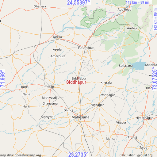
Siddhapur GPS coordinates[2]
23° 55' 4.188" North, 72° 22' 19.632" East
| Map corner | latitude | longitude |
|---|---|---|
| Upper-left | 24.55897°, | 71.669° |
| Center: | 23.91783°, | 72.37212° |
| Lower-right: | 23.2735°, | 73.07525° |
| Map W x H: | 142.9×142.9 km | = 88.8×88.8mi |
| max Lat: | 34.9274° ⇑42.2% North |
| Siddhapur: | 23.91783° |
| min Lat: | ⇓57.8% South 8.09008° |
| min Long | Siddhapur | max Long |
| 68.82655° | 72.37212° | 96.81° |
| W 3%⇐ | ⇒97% E |
Elevation
Elevation of Siddhapur is 140 m = 459 ft, and this is 155.6 m = 510 ft below average elevation for this country.
| Max E: |
3681 m = 12077 ft | 61.5% |
| Avg. | 295.6 m = 970 ft | |
| Siddhapur | 140 m = 459 ft | |
Min E: |
1 m = 3 ft | 38.5% |
See also: Siddhapur elevation on elevation.city.
Geographical zone
Siddhapur is located in North temperate zone (between Tropic of Cancer and the Arctic Circle). Distance of this Northern Tropic circle is 53.5 km =33.2 mi to South.| Distance of | km | miles | from Siddhapur |
|---|---|---|---|
| North Pole | 7347.6 | 4565.6 | to North |
| Arctic Circle | 4741.8 | 2946.4 | to North |
| Tropic Cancer | 53.5 | 33.2 | to South |
| Equator | 2659.4 | 1652.5 | to South |


Nearby cities:
15 places around Siddhapur: (largest is in red/bold)
• Chānasma
34.7 km =21.6 mi,  229°
229°
• Dīsa
42.4 km =26.3 mi,  332°
332°
• Hārij
53.5 km =33.2 mi,  242°
242°
• Jhulasan
66.3 km =41.2 mi,  171°
171°
• Kadi
68.9 km =42.8 mi,  183°
183°
• Kherālu
25.3 km =15.7 mi,  98°
98°
• Kānodar
19.2 km =11.9 mi,  6°
6°
• Mānsa
62 km =38.5 mi,  152°
152°
• Pālanpur
29 km =18 mi, 13°
• Pātan
25.8 km =16 mi,  253°
253°
• Un
61.3 km =38.1 mi,  266°
266°
• Unjha
12.8 km =8 mi, 171°
• Vadnagar
30.8 km =19.1 mi,  118°
118°
• Vijāpur
55 km =34.2 mi,  135°
135°
• Visnagar
30.5 km =19 mi, 143°
Sources, notices
• [Note1] Compared only with cities in India existing in our database
• [Src1] Map data: © OpenStreetMap contributors (CC-BY-SA)
• [Src2] Other city data from geonames.org with taken over terms of usage.
• [Src3] Geographical zone / Annual Mean Temperature by Robert A. Rohde @ Wikipedia
