Sānwer geodata
Sānwer (Madhya Pradesh) is a populated place; located in India in Asia/Kolkata (GMT+5.5) time zone. With population of 14,215 people, there are 2539 cities with bigger population in this country. Compared to other cities in India, 51.4% of cities are located further ↓South; 75.4% of cities are located further →East and 83.2% of cities have lower elevation than Sānwer. Note1


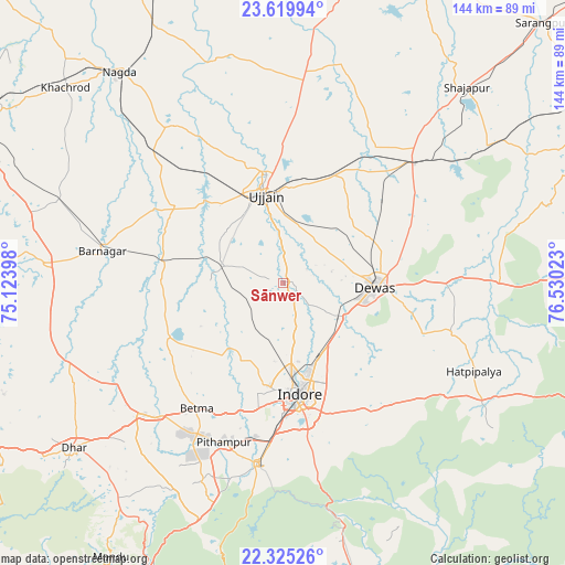
Sānwer GPS coordinates[2]
22° 58' 26.94" North, 75° 49' 37.56" East
| Map corner | latitude | longitude |
|---|---|---|
| Upper-left | 23.61994°, | 75.12398° |
| Center: | 22.97415°, | 75.8271° |
| Lower-right: | 22.32526°, | 76.53023° |
| Map W x H: | 144×144 km | = 89.5×89.5mi |
| max Lat: | 34.9274° ⇑48.6% North |
| Sānwer: | 22.97415° |
| min Lat: | ⇓51.4% South 8.09008° |
| min Long | Sānwer | max Long |
| 68.82655° | 75.8271° | 96.81° |
| W 24.6%⇐ | ⇒75.4% E |
Elevation
Elevation of Sānwer is 512 m = 1680 ft, and this is 216.4 m = 710 ft above average elevation for this country.
| Max E: |
3681 m = 12077 ft | 16.8% |
| Sānwer | 512 m 1680 ft | |
| Avg. | 295.6 m = 970 ft | |
Min E: |
1 m = 3 ft | 83.2% |
See also: India elevation on elevation.city.
Geographical zone
Sānwer is located in North Torrid zone (between Equator and Tropic of Cancer). Distance of this Northern Tropic circle is 51.4 km =31.9 mi to North.| Distance of | km | miles | from Sānwer |
|---|---|---|---|
| North Pole | 7452.6 | 4630.8 | to North |
| Arctic Circle | 4846.7 | 3011.6 | to North |
| Tropic Cancer | 51.4 | 31.9 | to North |
| Equator | 2554.5 | 1587.3 | to South |


Nearby cities:
15 places around Sānwer: (largest is in red/bold)
• Badnāwar
61.1 km =38 mi,  274°
274°
• Betma
38.7 km =24 mi,  214°
214°
• Depālpur
32.2 km =20 mi,  244°
244°
• Dewas
23.4 km =14.5 mi,  92°
92°
• Gautampura
31.5 km =19.6 mi, 272°
• Hātod
22 km =13.7 mi,  204°
204°
• Iklehra
60.7 km =37.7 mi,  71°
71°
• Indore
28.5 km =17.7 mi,  178°
178°
• Maksi
45.5 km =28.3 mi,  45°
45°
• Mānpur
63.9 km =39.7 mi, 199°
• Piploda
58 km =36 mi,  316°
316°
• Pithampur
43.5 km =27 mi, 197°
• Tarāna
45.7 km =28.4 mi,  28°
28°
• Ujjain
23.7 km =14.7 mi,  347°
347°
• Unhel
48.8 km =30.3 mi,  325°
325°
Sources, notices
• [Note1] Compared only with cities in India existing in our database
• [Src1] Map data: © OpenStreetMap contributors (CC-BY-SA)
• [Src2] Other city data from geonames.org with taken over terms of usage.
• [Src3] Geographical zone / Annual Mean Temperature by Robert A. Rohde @ Wikipedia
