Māndalgarh geodata
Māndalgarh (Rajasthan) is a populated place; located in India in Asia/Kolkata (GMT+5.5) time zone. With population of 21,569 people, there are 1929 cities with bigger population in this country. Compared to other cities in India, 64.4% of cities are located further ↓South; 82.1% of cities are located further →East and 74.6% of cities have lower elevation than Māndalgarh. Note1


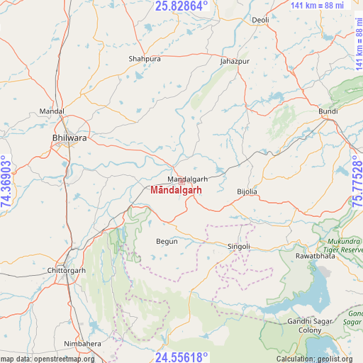
Māndalgarh GPS coordinates[2]
25° 11' 38.652" North, 75° 4' 19.74" East
| Map corner | latitude | longitude |
|---|---|---|
| Upper-left | 25.82864°, | 74.36903° |
| Center: | 25.19407°, | 75.07215° |
| Lower-right: | 24.55618°, | 75.77528° |
| Map W x H: | 141.5×141.5 km | = 87.9×87.9mi |
| max Lat: | 34.9274° ⇑35.6% North |
| Māndalgarh: | 25.19407° |
| min Lat: | ⇓64.4% South 8.09008° |
| min Long | Māndalgarh | max Long |
| 68.82655° | 75.07215° | 96.81° |
| W 17.9%⇐ | ⇒82.1% E |
Elevation
Elevation of Māndalgarh is 380 m = 1247 ft, and this is 84.4 m = 277 ft above average elevation for this country.
| Max E: |
3681 m = 12077 ft | 25.4% |
| Māndalgarh | 380 m 1247 ft | |
| Avg. | 295.6 m = 970 ft | |
Min E: |
1 m = 3 ft | 74.6% |
See also: India elevation on elevation.city.
Geographical zone
Māndalgarh is located in North temperate zone (between Tropic of Cancer and the Arctic Circle). Distance of this Northern Tropic circle is 195.4 km =121.4 mi to South.| Distance of | km | miles | from Māndalgarh |
|---|---|---|---|
| North Pole | 7205.7 | 4477.4 | to North |
| Arctic Circle | 4599.9 | 2858.2 | to North |
| Tropic Cancer | 195.4 | 121.4 | to South |
| Equator | 2801.3 | 1740.6 | to South |


Nearby cities:
15 places around Māndalgarh: (largest is in red/bold)
• Begūn
24.5 km =15.2 mi,  197°
197°
• Bhīlwāra
46.6 km =29 mi,  291°
291°
• Borkhera
67.7 km =42.1 mi,  57°
57°
• Būndi
63 km =39.1 mi, 64°
• Chittaurgarh
56.4 km =35 mi,  233°
233°
• Deoli
69.8 km =43.4 mi,  26°
26°
• Jahāzpur
51.6 km =32.1 mi,  23°
23°
• Jāwad
69.4 km =43.1 mi, 197°
• Kota
77.2 km =48 mi,  90°
90°
• Māndal
57.5 km =35.7 mi,  298°
298°
• Nīmbāhera
74.9 km =46.5 mi,  211°
211°
• Ratangarh
42.2 km =26.2 mi,  173°
173°
• Rāwatbhāta
60 km =37.3 mi,  119°
119°
• Shāhpura
49.7 km =30.9 mi,  342°
342°
• Singoli
34.1 km =21.2 mi,  137°
137°
Sources, notices
• [Note1] Compared only with cities in India existing in our database
• [Src1] Map data: © OpenStreetMap contributors (CC-BY-SA)
• [Src2] Other city data from geonames.org with taken over terms of usage.
• [Src3] Geographical zone / Annual Mean Temperature by Robert A. Rohde @ Wikipedia
