Rānīpur geodata
Rānīpur (Uttar Pradesh) is a populated place; located in India in Asia/Kolkata (GMT+5.5) time zone. With population of 18,820 people, there are 2143 cities with bigger population in this country. Compared to other cities in India, 64.8% of cities are located further ↓South; 59.4% of cities are located further ←West and 54% of cities have lower elevation than Rānīpur. Note1


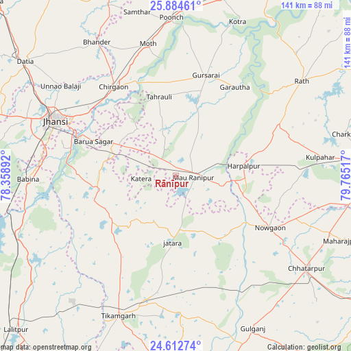
Rānīpur GPS coordinates[2]
25° 15' 1.224" North, 79° 3' 43.344" East
| Map corner | latitude | longitude |
|---|---|---|
| Upper-left | 25.88461°, | 78.35892° |
| Center: | 25.25034°, | 79.06204° |
| Lower-right: | 24.61274°, | 79.76517° |
| Map W x H: | 141.4×141.4 km | = 87.9×87.9mi |
| max Lat: | 34.9274° ⇑35.2% North |
| Rānīpur: | 25.25034° |
| min Lat: | ⇓64.8% South 8.09008° |
| min Long | Rānīpur | max Long |
| 68.82655° | 79.06204° | 96.81° |
| W 59.4%⇐ | ⇒40.6% E |
Elevation
Elevation of Rānīpur is 222 m = 728 ft, and this is 73.6 m = 241 ft below average elevation for this country.
| Max E: |
3681 m = 12077 ft | 46% |
| Avg. | 295.6 m = 970 ft | |
| Rānīpur | 222 m = 728 ft | |
Min E: |
1 m = 3 ft | 54% |
See also: India elevation on elevation.city.
Geographical zone
Rānīpur is located in North temperate zone (between Tropic of Cancer and the Arctic Circle). Distance of this Northern Tropic circle is 201.7 km =125.3 mi to South.| Distance of | km | miles | from Rānīpur |
|---|---|---|---|
| North Pole | 7199.5 | 4473.6 | to North |
| Arctic Circle | 4593.6 | 2854.3 | to North |
| Tropic Cancer | 201.7 | 125.3 | to South |
| Equator | 2807.6 | 1744.6 | to South |


Nearby cities:
15 places around Rānīpur: (largest is in red/bold)
• Baldeogarh
54.9 km =34.1 mi,  179°
179°
• Barāgaon
43.2 km =26.8 mi,  305°
305°
• Chirgaon
43.6 km =27.1 mi,  325°
325°
• Garautha
42.9 km =26.7 mi,  33°
33°
• Gursarāi
42.4 km =26.3 mi,  16°
16°
• Harpālpur
27.5 km =17.1 mi,  81°
81°
• Jatāra
26.8 km =16.7 mi, 182°
• Jhānsi
53.7 km =33.4 mi,  295°
295°
• Khailār
54.3 km =33.7 mi,  280°
280°
• Khargāpur
48.2 km =30 mi,  170°
170°
• Moth
54.1 km =33.6 mi,  348°
348°
• Orchha
43.9 km =27.3 mi, 284°
• Palera
30.6 km =19 mi,  146°
146°
• Pārīchha
41.8 km =26 mi, 313°
• Tori-Fatehpur
23.4 km =14.5 mi,  12°
12°
Sources, notices
• [Note1] Compared only with cities in India existing in our database
• [Src1] Map data: © OpenStreetMap contributors (CC-BY-SA)
• [Src2] Other city data from geonames.org with taken over terms of usage.
• [Src3] Geographical zone / Annual Mean Temperature by Robert A. Rohde @ Wikipedia
