Harpālpur geodata
Harpālpur (Madhya Pradesh) is a populated place; located in India in Asia/Kolkata (GMT+5.5) time zone. With population of 17,731 people, there are 2220 cities with bigger population in this country. Compared to other cities in India, 65% of cities are located further ↓South; 62.2% of cities are located further ←West and 52.3% of cities have lower elevation than Harpālpur. Note1


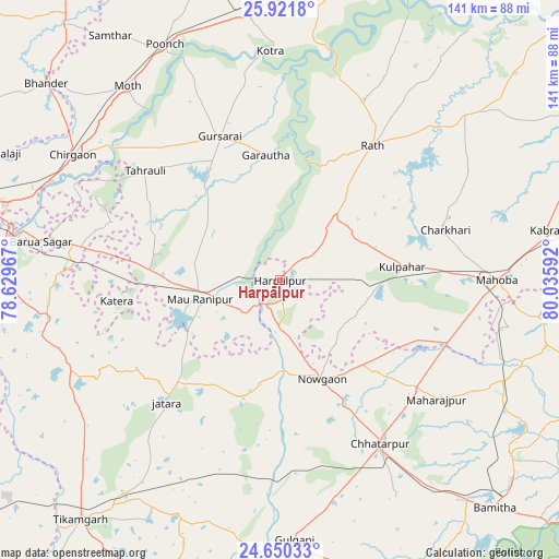
Harpālpur GPS coordinates[2]
25° 17' 15.828" North, 79° 19' 58.044" East
| Map corner | latitude | longitude |
|---|---|---|
| Upper-left | 25.9218°, | 78.62967° |
| Center: | 25.28773°, | 79.33279° |
| Lower-right: | 24.65033°, | 80.03592° |
| Map W x H: | 141.4×141.4 km | = 87.9×87.9mi |
| max Lat: | 34.9274° ⇑35% North |
| Harpālpur: | 25.28773° |
| min Lat: | ⇓65% South 8.09008° |
| min Long | Harpālpur | max Long |
| 68.82655° | 79.33279° | 96.81° |
| W 62.2%⇐ | ⇒37.8% E |
Elevation
Elevation of Harpālpur is 214 m = 702 ft, and this is 81.6 m = 268 ft below average elevation for this country.
| Max E: |
3681 m = 12077 ft | 47.7% |
| Avg. | 295.6 m = 970 ft | |
| Harpālpur | 214 m = 702 ft | |
Min E: |
1 m = 3 ft | 52.3% |
See also: India elevation on elevation.city.
Geographical zone
Harpālpur is located in North temperate zone (between Tropic of Cancer and the Arctic Circle). Distance of this Northern Tropic circle is 205.8 km =127.9 mi to South.| Distance of | km | miles | from Harpālpur |
|---|---|---|---|
| North Pole | 7195.3 | 4471 | to North |
| Arctic Circle | 4589.4 | 2851.7 | to North |
| Tropic Cancer | 205.8 | 127.9 | to South |
| Equator | 2811.7 | 1747.1 | to South |


Nearby cities:
15 places around Harpālpur: (largest is in red/bold)
• Charkhāri
43.7 km =27.2 mi,  72°
72°
• Chhatarpur
48.5 km =30.1 mi,  147°
147°
• Garautha
31.8 km =19.8 mi,  353°
353°
• Gohānd
50.4 km =31.3 mi,  25°
25°
• Gursarāi
39.7 km =24.7 mi,  337°
337°
• Jatāra
42.1 km =26.2 mi,  222°
222°
• Kharela
55.9 km =34.7 mi,  59°
59°
• Khargāpur
55.1 km =34.2 mi,  200°
200°
• Kotra
57.9 km =36 mi,  357°
357°
• Kulpahār
31 km =19.3 mi,  83°
83°
• Mahobā
54.5 km =33.9 mi,  89°
89°
• Palera
31.6 km =19.6 mi, 199°
• Rānīpur
27.5 km =17.1 mi,  261°
261°
• Rāth
41.4 km =25.7 mi, 34°
• Tori-Fatehpur
28.8 km =17.9 mi,  310°
310°
Sources, notices
• [Note1] Compared only with cities in India existing in our database
• [Src1] Map data: © OpenStreetMap contributors (CC-BY-SA)
• [Src2] Other city data from geonames.org with taken over terms of usage.
• [Src3] Geographical zone / Annual Mean Temperature by Robert A. Rohde @ Wikipedia
