Khargāpur geodata
Khargāpur (Madhya Pradesh) is a populated place; located in India in Asia/Kolkata (GMT+5.5) time zone. With population of 13,506 people, there are 2613 cities with bigger population in this country. Compared to other cities in India, 62.5% of cities are located further ↓South; 60.4% of cities are located further ←West and 67.3% of cities have lower elevation than Khargāpur. Note1


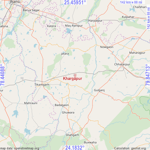
Khargāpur GPS coordinates[2]
24° 49' 22.8" North, 79° 8' 38.4" East
| Map corner | latitude | longitude |
|---|---|---|
| Upper-left | 25.45951°, | 78.44088° |
| Center: | 24.823°, | 79.144° |
| Lower-right: | 24.1832°, | 79.84713° |
| Map W x H: | 141.9×141.9 km | = 88.2×88.2mi |
| max Lat: | 34.9274° ⇑37.5% North |
| Khargāpur: | 24.823° |
| min Lat: | ⇓62.5% South 8.09008° |
| min Long | Khargāpur | max Long |
| 68.82655° | 79.144° | 96.81° |
| W 60.4%⇐ | ⇒39.6% E |
Elevation
Elevation of Khargāpur is 304 m = 997 ft, and this is 8.4 m = 28 ft above average elevation for this country.
| Max E: |
3681 m = 12077 ft | 32.7% |
| Khargāpur | 304 m 997 ft | |
| Avg. | 295.6 m = 970 ft | |
Min E: |
1 m = 3 ft | 67.3% |
See also: India elevation on elevation.city.
Geographical zone
Khargāpur is located in North temperate zone (between Tropic of Cancer and the Arctic Circle). Distance of this Northern Tropic circle is 154.1 km =95.8 mi to South.| Distance of | km | miles | from Khargāpur |
|---|---|---|---|
| North Pole | 7247 | 4503.1 | to North |
| Arctic Circle | 4641.1 | 2883.8 | to North |
| Tropic Cancer | 154.1 | 95.8 | to South |
| Equator | 2760.1 | 1715 | to South |


Nearby cities:
15 places around Khargāpur: (largest is in red/bold)
• Bakshwāho
65.2 km =40.5 mi,  167°
167°
• Baldeogarh
10.7 km =6.6 mi,  226°
226°
• Bijāwar
41.4 km =25.7 mi,  122°
122°
• Chhatarpur
46.1 km =28.6 mi,  76°
76°
• Harpālpur
55.1 km =34.2 mi,  20°
20°
• Jatāra
22.9 km =14.2 mi,  335°
335°
• Kulpahār
74.5 km =46.3 mi,  42°
42°
• Lalitpur
74.7 km =46.4 mi,  258°
258°
• Mahroni
49.6 km =30.8 mi,  237°
237°
• Palera
23.5 km =14.6 mi, 21°
• Rānīpur
48.2 km =30 mi,  350°
350°
• Shāhgarh
56.7 km =35.2 mi,  182°
182°
• Tori-Fatehpur
70.3 km =43.7 mi,  357°
357°
• Tālbahat
75.6 km =47 mi,  288°
288°
• Tīkamgarh
32.9 km =20.4 mi,  254°
254°
Sources, notices
• [Note1] Compared only with cities in India existing in our database
• [Src1] Map data: © OpenStreetMap contributors (CC-BY-SA)
• [Src2] Other city data from geonames.org with taken over terms of usage.
• [Src3] Geographical zone / Annual Mean Temperature by Robert A. Rohde @ Wikipedia
