Palera geodata
Palera (Madhya Pradesh) is a populated place; located in India in Asia/Kolkata (GMT+5.5) time zone. With population of 16,554 people, there are 2328 cities with bigger population in this country. Compared to other cities in India, 63.6% of cities are located further ↓South; 61.3% of cities are located further ←West and 57.4% of cities have lower elevation than Palera. Note1


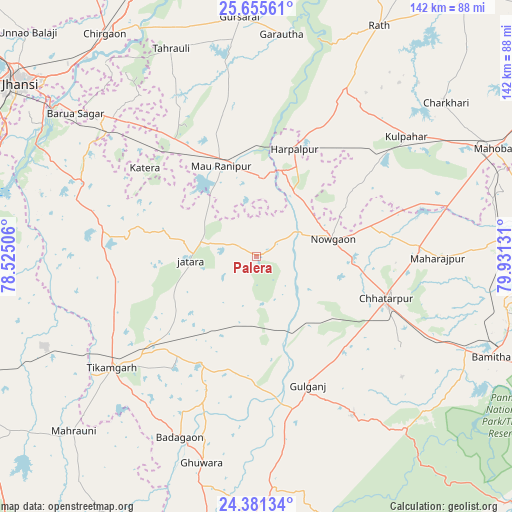
Palera GPS coordinates[2]
25° 1' 12.468" North, 79° 13' 41.448" East
| Map corner | latitude | longitude |
|---|---|---|
| Upper-left | 25.65561°, | 78.52506° |
| Center: | 25.02013°, | 79.22818° |
| Lower-right: | 24.38134°, | 79.93131° |
| Map W x H: | 141.7×141.7 km | = 88×88mi |
| max Lat: | 34.9274° ⇑36.4% North |
| Palera: | 25.02013° |
| min Lat: | ⇓63.6% South 8.09008° |
| min Long | Palera | max Long |
| 68.82655° | 79.22818° | 96.81° |
| W 61.3%⇐ | ⇒38.7% E |
Elevation
Elevation of Palera is 237 m = 778 ft, and this is 58.6 m = 192 ft below average elevation for this country.
| Max E: |
3681 m = 12077 ft | 42.6% |
| Avg. | 295.6 m = 970 ft | |
| Palera | 237 m = 778 ft | |
Min E: |
1 m = 3 ft | 57.4% |
See also: India elevation on elevation.city.
Geographical zone
Palera is located in North temperate zone (between Tropic of Cancer and the Arctic Circle). Distance of this Northern Tropic circle is 176.1 km =109.4 mi to South.| Distance of | km | miles | from Palera |
|---|---|---|---|
| North Pole | 7225.1 | 4489.5 | to North |
| Arctic Circle | 4619.2 | 2870.2 | to North |
| Tropic Cancer | 176.1 | 109.4 | to South |
| Equator | 2782 | 1728.7 | to South |


Nearby cities:
15 places around Palera: (largest is in red/bold)
• Baldeogarh
33.5 km =20.8 mi,  208°
208°
• Bijāwar
51.4 km =31.9 mi,  149°
149°
• Charkhāri
67.5 km =41.9 mi,  50°
50°
• Chhatarpur
38.1 km =23.7 mi,  107°
107°
• Garautha
61.7 km =38.3 mi,  6°
6°
• Gursarāi
66.5 km =41.3 mi,  355°
355°
• Harpālpur
31.6 km =19.6 mi,  19°
19°
• Jatāra
18.1 km =11.2 mi,  266°
266°
• Khargāpur
23.5 km =14.6 mi,  201°
201°
• Kulpahār
53.1 km =33 mi, 51°
• Mahroni
69.9 km =43.4 mi,  226°
226°
• Orchha
69.7 km =43.3 mi,  301°
301°
• Rānīpur
30.6 km =19 mi,  326°
326°
• Tori-Fatehpur
49.7 km =30.9 mi,  346°
346°
• Tīkamgarh
50.6 km =31.4 mi, 232°
Sources, notices
• [Note1] Compared only with cities in India existing in our database
• [Src1] Map data: © OpenStreetMap contributors (CC-BY-SA)
• [Src2] Other city data from geonames.org with taken over terms of usage.
• [Src3] Geographical zone / Annual Mean Temperature by Robert A. Rohde @ Wikipedia
