Rāmgarh geodata
Rāmgarh (Jammu and Kashmir) is a populated place; located in India in Asia/Kolkata (GMT+5.5) time zone. With population of 4,945 people, there are 3346 cities with bigger population in this country. Compared to other cities in India, 99.1% of cities are located further ↓South; 88.2% of cities are located further →East and 97.4% of cities have lower elevation than Rāmgarh. Note1


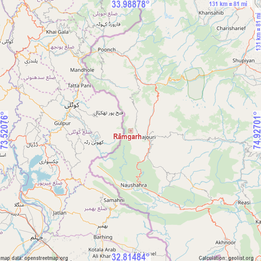
Rāmgarh GPS coordinates[2]
33° 24' 13.644" North, 74° 13' 25.968" East
| Map corner | latitude | longitude |
|---|---|---|
| Upper-left | 33.98878°, | 73.52076° |
| Center: | 33.40379°, | 74.22388° |
| Lower-right: | 32.81484°, | 74.92701° |
| Map W x H: | 130.5×130.5 km | = 81.1×81.1mi |
| max Lat: | 34.9274° ⇑0.9% North |
| Rāmgarh: | 33.40379° |
| min Lat: | ⇓99.1% South 8.09008° |
| min Long | Rāmgarh | max Long |
| 68.82655° | 74.22388° | 96.81° |
| W 11.8%⇐ | ⇒88.2% E |
Elevation
Elevation of Rāmgarh is 1373 m = 4505 ft, and this is 1077.4 m = 3535 ft above average elevation for this country.
| Max E: |
3681 m = 12077 ft | 2.6% |
| Rāmgarh | 1373 m 4505 ft | |
| Avg. | 295.6 m = 970 ft | |
Min E: |
1 m = 3 ft | 97.4% |
See also: India elevation on elevation.city.
Geographical zone
Rāmgarh is located in North temperate zone (between Tropic of Cancer and the Arctic Circle). Distance of this Northern Tropic circle is 1108.2 km =688.6 mi to South.| Distance of | km | miles | from Rāmgarh |
|---|---|---|---|
| North Pole | 6292.9 | 3910.2 | to North |
| Arctic Circle | 3687 | 2291 | to North |
| Tropic Cancer | 1108.2 | 688.6 | to South |
| Equator | 3714.2 | 2307.9 | to South |


Nearby cities:
15 places around Rāmgarh: (largest is in red/bold)
• Akhnūr
76.3 km =47.4 mi,  141°
141°
• Gulmarg
73.7 km =45.8 mi,  11°
11°
• Jauriān
71.5 km =44.4 mi,  152°
152°
• Katra
80.2 km =49.8 mi,  124°
124°
• Kulgam
78.4 km =48.7 mi,  70°
70°
• Kupwāra
69.8 km =43.4 mi,  3°
3°
• Nawānshahr
76.5 km =47.5 mi,  158°
158°
• Pulwama
81.5 km =50.6 mi,  50°
50°
• Pūnch
42.5 km =26.4 mi,  343°
343°
• Rajaori
8.5 km =5.3 mi,  111°
111°
• Riāsi
67 km =41.6 mi, 122°
• Shupīyan
66.4 km =41.3 mi,  58°
58°
• Thanna Mandi
21.2 km =13.2 mi,  43°
43°
• Tsrār Sharīf
71.6 km =44.5 mi, 44°
• Uri
76.9 km =47.8 mi,  348°
348°
Sources, notices
• [Note1] Compared only with cities in India existing in our database
• [Src1] Map data: © OpenStreetMap contributors (CC-BY-SA)
• [Src2] Other city data from geonames.org with taken over terms of usage.
• [Src3] Geographical zone / Annual Mean Temperature by Robert A. Rohde @ Wikipedia
