Pukhrāyān geodata
Pukhrāyān (Uttar Pradesh) is a populated place; located in India in Asia/Kolkata (GMT+5.5) time zone. With population of 22,555 people, there are 1872 cities with bigger population in this country. Compared to other cities in India, 72.1% of cities are located further ↓South; 66.7% of cities are located further ←West and 62.8% of cities have higher elevation than Pukhrāyān. Note1


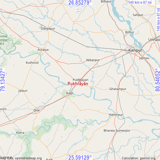
Pukhrāyān GPS coordinates[2]
26° 13' 25.5" North, 79° 50' 14.604" East
| Map corner | latitude | longitude |
|---|---|---|
| Upper-left | 26.85279°, | 79.13427° |
| Center: | 26.22375°, | 79.83739° |
| Lower-right: | 25.59129°, | 80.54052° |
| Map W x H: | 140.3×140.3 km | = 87.2×87.2mi |
| max Lat: | 34.9274° ⇑27.9% North |
| Pukhrāyān: | 26.22375° |
| min Lat: | ⇓72.1% South 8.09008° |
| min Long | Pukhrāyān | max Long |
| 68.82655° | 79.83739° | 96.81° |
| W 66.7%⇐ | ⇒33.3% E |
Elevation
Elevation of Pukhrāyān is 133 m = 436 ft, and this is 162.6 m = 533 ft below average elevation for this country.
| Max E: |
3681 m = 12077 ft | 62.8% |
| Avg. | 295.6 m = 970 ft | |
| Pukhrāyān | 133 m = 436 ft | |
Min E: |
1 m = 3 ft | 37.2% |
See also: India elevation on elevation.city.
Geographical zone
Pukhrāyān is located in North temperate zone (between Tropic of Cancer and the Arctic Circle). Distance of this Northern Tropic circle is 309.9 km =192.6 mi to South.| Distance of | km | miles | from Pukhrāyān |
|---|---|---|---|
| North Pole | 7091.3 | 4406.3 | to North |
| Arctic Circle | 4485.4 | 2787.1 | to North |
| Tropic Cancer | 309.9 | 192.6 | to South |
| Equator | 2915.8 | 1811.8 | to South |


Nearby cities:
15 places around Pukhrāyān: (largest is in red/bold)
• Akbarpur
21 km =13 mi,  32°
32°
• Auraiya
42.3 km =26.3 mi,  309°
309°
• Ghātampur
33.9 km =21.1 mi,  103°
103°
• Hamīrpur
43.1 km =26.8 mi,  133°
133°
• Jhīnjhak
38.9 km =24.2 mi,  344°
344°
• Jālaun
50.7 km =31.5 mi,  260°
260°
• Kadaura
26.5 km =16.5 mi,  179°
179°
• Kurāra
31 km =19.3 mi,  150°
150°
• Kālpi
15.8 km =9.8 mi,  221°
221°
• Nawābganj
56 km =34.8 mi,  57°
57°
• Orai
46.3 km =28.8 mi,  235°
235°
• Phaphūnd
55.9 km =34.7 mi,  318°
318°
• Rura
30.3 km =18.8 mi,  12°
12°
• Sarīla
52.4 km =32.6 mi,  198°
198°
• Sikandra
26.1 km =16.2 mi, 307°
Sources, notices
• [Note1] Compared only with cities in India existing in our database
• [Src1] Map data: © OpenStreetMap contributors (CC-BY-SA)
• [Src2] Other city data from geonames.org with taken over terms of usage.
• [Src3] Geographical zone / Annual Mean Temperature by Robert A. Rohde @ Wikipedia
