Phaphūnd geodata
Phaphūnd (Uttar Pradesh) is a populated place; located in India in Asia/Kolkata (GMT+5.5) time zone. With population of 16,675 people, there are 2316 cities with bigger population in this country. Compared to other cities in India, 75.4% of cities are located further ↓South; 63.4% of cities are located further ←West and 60.3% of cities have higher elevation than Phaphūnd. Note1


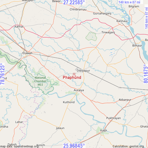
Phaphūnd GPS coordinates[2]
26° 35' 55.968" North, 79° 27' 51.732" East
| Map corner | latitude | longitude |
|---|---|---|
| Upper-left | 27.22585°, | 78.76125° |
| Center: | 26.59888°, | 79.46437° |
| Lower-right: | 25.96845°, | 80.1675° |
| Map W x H: | 139.8×139.8 km | = 86.9×86.9mi |
| max Lat: | 34.9274° ⇑24.6% North |
| Phaphūnd: | 26.59888° |
| min Lat: | ⇓75.4% South 8.09008° |
| min Long | Phaphūnd | max Long |
| 68.82655° | 79.46437° | 96.81° |
| W 63.4%⇐ | ⇒36.6% E |
Elevation
Elevation of Phaphūnd is 147 m = 482 ft, and this is 148.6 m = 488 ft below average elevation for this country.
| Max E: |
3681 m = 12077 ft | 60.3% |
| Avg. | 295.6 m = 970 ft | |
| Phaphūnd | 147 m = 482 ft | |
Min E: |
1 m = 3 ft | 39.7% |
See also: India elevation on elevation.city.
Geographical zone
Phaphūnd is located in North temperate zone (between Tropic of Cancer and the Arctic Circle). Distance of this Northern Tropic circle is 351.6 km =218.5 mi to South.| Distance of | km | miles | from Phaphūnd |
|---|---|---|---|
| North Pole | 7049.5 | 4380.4 | to North |
| Arctic Circle | 4443.7 | 2761.2 | to North |
| Tropic Cancer | 351.6 | 218.5 | to South |
| Equator | 2957.5 | 1837.7 | to South |


Nearby cities:
15 places around Phaphūnd: (largest is in red/bold)
• Auraiya
15.5 km =9.6 mi,  163°
163°
• Bakewar
29.5 km =18.3 mi,  283°
283°
• Bharthana
29.5 km =18.3 mi,  305°
305°
• Bidhūna
23 km =14.3 mi,  10°
10°
• Etāwah
48.2 km =30 mi,  294°
294°
• Indergarh
42.7 km =26.5 mi,  28°
28°
• Jhīnjhak
27.2 km =16.9 mi,  98°
98°
• Kishni
51.4 km =31.9 mi,  337°
337°
• Lakhnā
32 km =19.9 mi, 279°
• Mādhogarh
45.4 km =28.2 mi,  217°
217°
• Rura
45.1 km =28 mi,  105°
105°
• Rāmpura
39.4 km =24.5 mi,  225°
225°
• Sarai Ekdil
40.2 km =25 mi, 293°
• Saurikh
48.1 km =29.9 mi,  2°
2°
• Sikandra
30.6 km =19 mi,  147°
147°
Sources, notices
• [Note1] Compared only with cities in India existing in our database
• [Src1] Map data: © OpenStreetMap contributors (CC-BY-SA)
• [Src2] Other city data from geonames.org with taken over terms of usage.
• [Src3] Geographical zone / Annual Mean Temperature by Robert A. Rohde @ Wikipedia
