Parīchhatgarh geodata
Parīchhatgarh (Uttar Pradesh) is a populated place; located in India in Asia/Kolkata (GMT+5.5) time zone. With population of 18,990 people, there are 2126 cities with bigger population in this country. Compared to other cities in India, 89% of cities are located further ↓South; 52% of cities are located further →East and 56.5% of cities have lower elevation than Parīchhatgarh. Note1


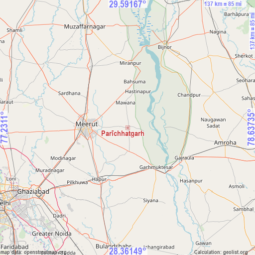
Parīchhatgarh GPS coordinates[2]
28° 58' 42.276" North, 77° 56' 3.192" East
| Map corner | latitude | longitude |
|---|---|---|
| Upper-left | 29.59167°, | 77.2311° |
| Center: | 28.97841°, | 77.93422° |
| Lower-right: | 28.36149°, | 78.63735° |
| Map W x H: | 136.8×136.8 km | = 85×85mi |
| max Lat: | 34.9274° ⇑11% North |
| Parīchhatgarh: | 28.97841° |
| min Lat: | ⇓89% South 8.09008° |
| min Long | Parīchhatgarh | max Long |
| 68.82655° | 77.93422° | 96.81° |
| W 48%⇐ | ⇒52% E |
Elevation
Elevation of Parīchhatgarh is 232 m = 761 ft, and this is 63.6 m = 209 ft below average elevation for this country.
| Max E: |
3681 m = 12077 ft | 43.5% |
| Avg. | 295.6 m = 970 ft | |
| Parīchhatgarh | 232 m = 761 ft | |
Min E: |
1 m = 3 ft | 56.5% |
See also: India elevation on elevation.city.
Geographical zone
Parīchhatgarh is located in North temperate zone (between Tropic of Cancer and the Arctic Circle). Distance of this Northern Tropic circle is 616.2 km =382.9 mi to South.| Distance of | km | miles | from Parīchhatgarh |
|---|---|---|---|
| North Pole | 6785 | 4216 | to North |
| Arctic Circle | 4179.1 | 2596.8 | to North |
| Tropic Cancer | 616.2 | 382.9 | to South |
| Equator | 3222.1 | 2002.1 | to South |


Nearby cities:
15 places around Parīchhatgarh: (largest is in red/bold)
• Babugarh
29.6 km =18.4 mi,  196°
196°
• Bachhraon
29.8 km =18.5 mi,  101°
101°
• Bahsūma
25 km =15.5 mi,  8°
8°
• Daurāla
26.9 km =16.7 mi,  303°
303°
• Dhanaura
31.4 km =19.5 mi,  93°
93°
• Gajraula
33.2 km =20.6 mi,  116°
116°
• Garhmuktesar
26.8 km =16.7 mi,  142°
142°
• Hastināpur
21.5 km =13.4 mi,  19°
19°
• Hāpur
31.4 km =19.5 mi,  208°
208°
• Kharkhauda
24.5 km =15.2 mi,  229°
229°
• Kithor
12.4 km =7.7 mi,  178°
178°
• Lāwar Khās
21.2 km =13.2 mi,  314°
314°
• Mawāna
13.9 km =8.6 mi,  355°
355°
• Meerut
22.2 km =13.8 mi,  270°
270°
• Phalauda
25.4 km =15.8 mi,  336°
336°
Sources, notices
• [Note1] Compared only with cities in India existing in our database
• [Src1] Map data: © OpenStreetMap contributors (CC-BY-SA)
• [Src2] Other city data from geonames.org with taken over terms of usage.
• [Src3] Geographical zone / Annual Mean Temperature by Robert A. Rohde @ Wikipedia
