Kharkhauda geodata
Kharkhauda (Uttar Pradesh) is a populated place; located in India in Asia/Kolkata (GMT+5.5) time zone. With population of 13,189 people, there are 2635 cities with bigger population in this country. Compared to other cities in India, 88.4% of cities are located further ↓South; 54.5% of cities are located further →East and 54.7% of cities have lower elevation than Kharkhauda. Note1


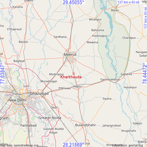
Kharkhauda GPS coordinates[2]
28° 50' 11.184" North, 77° 44' 29.724" East
| Map corner | latitude | longitude |
|---|---|---|
| Upper-left | 29.45055°, | 77.03847° |
| Center: | 28.83644°, | 77.74159° |
| Lower-right: | 28.21869°, | 78.44472° |
| Map W x H: | 137×137 km | = 85.1×85.1mi |
| max Lat: | 34.9274° ⇑11.6% North |
| Kharkhauda: | 28.83644° |
| min Lat: | ⇓88.4% South 8.09008° |
| min Long | Kharkhauda | max Long |
| 68.82655° | 77.74159° | 96.81° |
| W 45.5%⇐ | ⇒54.5% E |
Elevation
Elevation of Kharkhauda is 225 m = 738 ft, and this is 70.6 m = 232 ft below average elevation for this country.
| Max E: |
3681 m = 12077 ft | 45.3% |
| Avg. | 295.6 m = 970 ft | |
| Kharkhauda | 225 m = 738 ft | |
Min E: |
1 m = 3 ft | 54.7% |
See also: India elevation on elevation.city.
Geographical zone
Kharkhauda is located in North temperate zone (between Tropic of Cancer and the Arctic Circle). Distance of this Northern Tropic circle is 600.4 km =373.1 mi to South.| Distance of | km | miles | from Kharkhauda |
|---|---|---|---|
| North Pole | 6800.8 | 4225.8 | to North |
| Arctic Circle | 4194.9 | 2606.6 | to North |
| Tropic Cancer | 600.4 | 373.1 | to South |
| Equator | 3206.3 | 1992.3 | to South |


Nearby cities:
15 places around Kharkhauda: (largest is in red/bold)
• Babugarh
16.2 km =10.1 mi,  140°
140°
• Daurāla
31 km =19.3 mi,  353°
353°
• Dāsna
27.7 km =17.2 mi,  230°
230°
• Farīdnagar
13.2 km =8.2 mi,  235°
235°
• Gulāothi
27.9 km =17.3 mi,  169°
169°
• Hāpur
12.4 km =7.7 mi,  162°
162°
• Kithor
19.5 km =12.1 mi,  80°
80°
• Lāwar Khās
30.7 km =19.1 mi,  6°
6°
• Mawāna
34.4 km =21.4 mi,  30°
30°
• Meerut
16.3 km =10.1 mi, 347°
• Murādnagar
24.5 km =15.2 mi,  255°
255°
• Niwāri
20.3 km =12.6 mi,  282°
282°
• Parīchhatgarh
24.5 km =15.2 mi,  49°
49°
• Pilkhua
16.1 km =10 mi,  211°
211°
• Saidpur
29.9 km =18.6 mi,  146°
146°
Sources, notices
• [Note1] Compared only with cities in India existing in our database
• [Src1] Map data: © OpenStreetMap contributors (CC-BY-SA)
• [Src2] Other city data from geonames.org with taken over terms of usage.
• [Src3] Geographical zone / Annual Mean Temperature by Robert A. Rohde @ Wikipedia
