Babugarh geodata
Babugarh (Uttar Pradesh) is a populated place; located in India in Asia/Kolkata (GMT+5.5) time zone. With population of 7,156 people, there are 3199 cities with bigger population in this country. Compared to other cities in India, 88% of cities are located further ↓South; 53.1% of cities are located further →East and 52.6% of cities have lower elevation than Babugarh. Note1


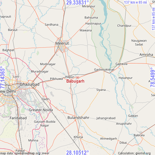
Babugarh GPS coordinates[2]
28° 43' 24.708" North, 77° 50' 48.372" East
| Map corner | latitude | longitude |
|---|---|---|
| Upper-left | 29.33831°, | 77.14365° |
| Center: | 28.72353°, | 77.84677° |
| Lower-right: | 28.10512°, | 78.5499° |
| Map W x H: | 137.1×137.1 km | = 85.2×85.2mi |
| max Lat: | 34.9274° ⇑12% North |
| Babugarh: | 28.72353° |
| min Lat: | ⇓88% South 8.09008° |
| min Long | Babugarh | max Long |
| 68.82655° | 77.84677° | 96.81° |
| W 46.9%⇐ | ⇒53.1% E |
Elevation
Elevation of Babugarh is 216 m = 709 ft, and this is 79.6 m = 261 ft below average elevation for this country.
| Max E: |
3681 m = 12077 ft | 47.4% |
| Avg. | 295.6 m = 970 ft | |
| Babugarh | 216 m = 709 ft | |
Min E: |
1 m = 3 ft | 52.6% |
See also: India elevation on elevation.city.
Geographical zone
Babugarh is located in North temperate zone (between Tropic of Cancer and the Arctic Circle). Distance of this Northern Tropic circle is 587.8 km =365.2 mi to South.| Distance of | km | miles | from Babugarh |
|---|---|---|---|
| North Pole | 6813.3 | 4233.6 | to North |
| Arctic Circle | 4207.4 | 2614.4 | to North |
| Tropic Cancer | 587.8 | 365.2 | to South |
| Equator | 3193.8 | 1984.5 | to South |


Nearby cities:
15 places around Babugarh: (largest is in red/bold)
• Dādri
34.3 km =21.3 mi,  236°
236°
• Dāsna
32 km =19.9 mi,  260°
260°
• Farīdnagar
21.8 km =13.5 mi,  283°
283°
• Garhmuktesar
25.9 km =16.1 mi,  74°
74°
• Gulāothi
15.8 km =9.8 mi,  199°
199°
• Hāpur
6.5 km =4 mi, 276°
• Kharkhauda
16.2 km =10.1 mi,  320°
320°
• Khānpur
30 km =18.6 mi,  134°
134°
• Kithor
18.3 km =11.4 mi,  29°
29°
• Meerut
31.6 km =19.6 mi,  334°
334°
• Murādnagar
34.5 km =21.4 mi, 280°
• Parīchhatgarh
29.6 km =18.4 mi,  16°
16°
• Pilkhua
18.6 km =11.6 mi,  266°
266°
• Saidpur
13.9 km =8.6 mi,  154°
154°
• Sikandarābād
33.4 km =20.8 mi,  205°
205°
Sources, notices
• [Note1] Compared only with cities in India existing in our database
• [Src1] Map data: © OpenStreetMap contributors (CC-BY-SA)
• [Src2] Other city data from geonames.org with taken over terms of usage.
• [Src3] Geographical zone / Annual Mean Temperature by Robert A. Rohde @ Wikipedia
