Machhlīshahr geodata
Machhlīshahr (Uttar Pradesh) is a populated place; located in India in Asia/Kolkata (GMT+5.5) time zone. With population of 25,247 people, there are 1686 cities with bigger population in this country. Compared to other cities in India, 68.4% of cities are located further ↓South; 77.6% of cities are located further ←West and 68.7% of cities have higher elevation than Machhlīshahr. Note1


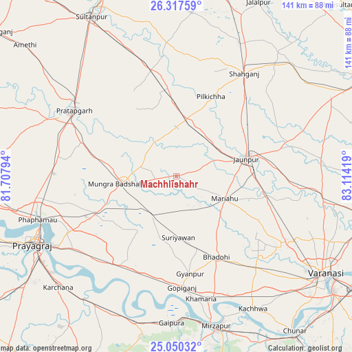
Machhlīshahr GPS coordinates[2]
25° 41' 8.304" North, 82° 24' 39.816" East
| Map corner | latitude | longitude |
|---|---|---|
| Upper-left | 26.31759°, | 81.70794° |
| Center: | 25.68564°, | 82.41106° |
| Lower-right: | 25.05032°, | 83.11419° |
| Map W x H: | 140.9×140.9 km | = 87.6×87.6mi |
| max Lat: | 34.9274° ⇑31.6% North |
| Machhlīshahr: | 25.68564° |
| min Lat: | ⇓68.4% South 8.09008° |
| min Long | Machhlīshahr | max Long |
| 68.82655° | 82.41106° | 96.81° |
| W 77.6%⇐ | ⇒22.4% E |
Elevation
Elevation of Machhlīshahr is 98 m = 322 ft, and this is 197.6 m = 648 ft below average elevation for this country.
| Max E: |
3681 m = 12077 ft | 68.7% |
| Avg. | 295.6 m = 970 ft | |
| Machhlīshahr | 98 m = 322 ft | |
Min E: |
1 m = 3 ft | 31.3% |
See also: India elevation on elevation.city.
Geographical zone
Machhlīshahr is located in North temperate zone (between Tropic of Cancer and the Arctic Circle). Distance of this Northern Tropic circle is 250.1 km =155.4 mi to South.| Distance of | km | miles | from Machhlīshahr |
|---|---|---|---|
| North Pole | 7151.1 | 4443.5 | to North |
| Arctic Circle | 4545.2 | 2824.3 | to North |
| Tropic Cancer | 250.1 | 155.4 | to South |
| Equator | 2856 | 1774.6 | to South |


Nearby cities:
15 places around Machhlīshahr: (largest is in red/bold)
• Barāgaon
49.7 km =30.9 mi,  124°
124°
• Bela
49.1 km =30.5 mi,  302°
302°
• Bhadohi
36 km =22.4 mi,  153°
153°
• Gyānpur
39.6 km =24.6 mi,  171°
171°
• Handiā
42.3 km =26.3 mi,  212°
212°
• Jaunpur
28.6 km =17.8 mi,  74°
74°
• Kirākat
50.9 km =31.6 mi,  96°
96°
• Mariāhu
21.3 km =13.2 mi, 115°
• Mau Aimma
48.9 km =30.4 mi,  271°
271°
• Patti
33.6 km =20.9 mi,  321°
321°
• Phulpur
35.6 km =22.1 mi,  244°
244°
• Pratāpgarh
52.4 km =32.6 mi, 296°
• Shāhganj
48.8 km =30.3 mi,  34°
34°
• Suriānwān
24.7 km =15.3 mi,  178°
178°
• Zafarābād
32.3 km =20.1 mi,  87°
87°
Sources, notices
• [Note1] Compared only with cities in India existing in our database
• [Src1] Map data: © OpenStreetMap contributors (CC-BY-SA)
• [Src2] Other city data from geonames.org with taken over terms of usage.
• [Src3] Geographical zone / Annual Mean Temperature by Robert A. Rohde @ Wikipedia
