Suriānwān geodata
Suriānwān (Uttar Pradesh) is a populated place; located in India in Asia/Kolkata (GMT+5.5) time zone. With population of 19,157 people, there are 2114 cities with bigger population in this country. Compared to other cities in India, 66.6% of cities are located further ↓South; 77.7% of cities are located further ←West and 70.2% of cities have higher elevation than Suriānwān. Note1


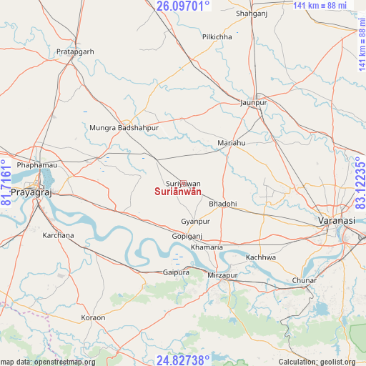
Suriānwān GPS coordinates[2]
25° 27' 49.932" North, 82° 25' 9.192" East
| Map corner | latitude | longitude |
|---|---|---|
| Upper-left | 26.09701°, | 81.7161° |
| Center: | 25.46387°, | 82.41922° |
| Lower-right: | 24.82738°, | 83.12235° |
| Map W x H: | 141.2×141.2 km | = 87.7×87.7mi |
| max Lat: | 34.9274° ⇑33.4% North |
| Suriānwān: | 25.46387° |
| min Lat: | ⇓66.6% South 8.09008° |
| min Long | Suriānwān | max Long |
| 68.82655° | 82.41922° | 96.81° |
| W 77.7%⇐ | ⇒22.3% E |
Elevation
Elevation of Suriānwān is 91 m = 299 ft, and this is 204.6 m = 671 ft below average elevation for this country.
| Max E: |
3681 m = 12077 ft | 70.2% |
| Avg. | 295.6 m = 970 ft | |
| Suriānwān | 91 m = 299 ft | |
Min E: |
1 m = 3 ft | 29.8% |
See also: India elevation on elevation.city.
Geographical zone
Suriānwān is located in North temperate zone (between Tropic of Cancer and the Arctic Circle). Distance of this Northern Tropic circle is 225.4 km =140.1 mi to South.| Distance of | km | miles | from Suriānwān |
|---|---|---|---|
| North Pole | 7175.7 | 4458.8 | to North |
| Arctic Circle | 4569.9 | 2839.6 | to North |
| Tropic Cancer | 225.4 | 140.1 | to South |
| Equator | 2831.3 | 1759.3 | to South |


Nearby cities:
15 places around Suriānwān: (largest is in red/bold)
• Barāgaon
40.1 km =24.9 mi,  95°
95°
• Bhadohi
17 km =10.6 mi,  116°
116°
• Gyānpur
15.3 km =9.5 mi,  162°
162°
• Handiā
25.9 km =16.1 mi,  244°
244°
• Jaunpur
41.9 km =26 mi,  39°
39°
• Jhūsi
51.7 km =32.1 mi,  266°
266°
• Kachhwa
41.2 km =25.6 mi,  134°
134°
• Kirākat
53.4 km =33.2 mi,  68°
68°
• Machhlīshahr
24.7 km =15.3 mi,  358°
358°
• Mariāhu
24.2 km =15 mi,  49°
49°
• Mirzāpur
38.4 km =23.9 mi, 157°
• Patti
55.4 km =34.4 mi,  336°
336°
• Phulpur
34.4 km =21.4 mi,  285°
285°
• Sirsā
39.7 km =24.7 mi, 235°
• Zafarābād
40.9 km =25.4 mi, 50°
Sources, notices
• [Note1] Compared only with cities in India existing in our database
• [Src1] Map data: © OpenStreetMap contributors (CC-BY-SA)
• [Src2] Other city data from geonames.org with taken over terms of usage.
• [Src3] Geographical zone / Annual Mean Temperature by Robert A. Rohde @ Wikipedia
