Mau Aimma geodata
Mau Aimma (Uttar Pradesh) is a populated place; located in India in Asia/Kolkata (GMT+5.5) time zone. With population of 20,123 people, there are 2029 cities with bigger population in this country. Compared to other cities in India, 68.4% of cities are located further ↓South; 76.3% of cities are located further ←West and 67.9% of cities have higher elevation than Mau Aimma. Note1


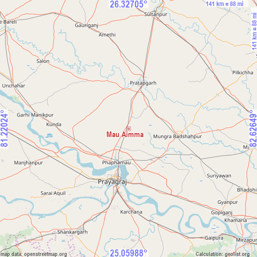
Mau Aimma GPS coordinates[2]
25° 41' 42.54" North, 81° 55' 24.096" East
| Map corner | latitude | longitude |
|---|---|---|
| Upper-left | 26.32705°, | 81.22024° |
| Center: | 25.69515°, | 81.92336° |
| Lower-right: | 25.05988°, | 82.62649° |
| Map W x H: | 140.9×140.9 km | = 87.6×87.6mi |
| max Lat: | 34.9274° ⇑31.6% North |
| Mau Aimma: | 25.69515° |
| min Lat: | ⇓68.4% South 8.09008° |
| min Long | Mau Aimma | max Long |
| 68.82655° | 81.92336° | 96.81° |
| W 76.3%⇐ | ⇒23.7% E |
Elevation
Elevation of Mau Aimma is 103 m = 338 ft, and this is 192.6 m = 632 ft below average elevation for this country.
| Max E: |
3681 m = 12077 ft | 67.9% |
| Avg. | 295.6 m = 970 ft | |
| Mau Aimma | 103 m = 338 ft | |
Min E: |
1 m = 3 ft | 32.1% |
See also: India elevation on elevation.city.
Geographical zone
Mau Aimma is located in North temperate zone (between Tropic of Cancer and the Arctic Circle). Distance of this Northern Tropic circle is 251.1 km =156 mi to South.| Distance of | km | miles | from Mau Aimma |
|---|---|---|---|
| North Pole | 7150 | 4442.8 | to North |
| Arctic Circle | 4544.1 | 2823.6 | to North |
| Tropic Cancer | 251.1 | 156 | to South |
| Equator | 2857 | 1775.3 | to South |


Nearby cities:
15 places around Mau Aimma: (largest is in red/bold)
• Allahābād
29 km =18 mi,  196°
196°
• Amethī
52.7 km =32.7 mi,  347°
347°
• Antu
40.2 km =25 mi,  357°
357°
• Bela
26.1 km =16.2 mi,  16°
16°
• Bharwāri
45.8 km =28.5 mi,  250°
250°
• Chail
41.8 km =26 mi,  224°
224°
• Handiā
45.3 km =28.1 mi,  144°
144°
• Jhūsi
28.7 km =17.8 mi,  183°
183°
• Kunda
41.1 km =25.5 mi,  273°
273°
• Lālganj
34.2 km =21.3 mi,  320°
320°
• Machhlīshahr
48.9 km =30.4 mi,  91°
91°
• Patti
37.5 km =23.3 mi,  47°
47°
• Phulpur
23.3 km =14.5 mi,  134°
134°
• Pratāpgarh
22.3 km =13.9 mi,  4°
4°
• Sirsā
50.9 km =31.6 mi,  160°
160°
Sources, notices
• [Note1] Compared only with cities in India existing in our database
• [Src1] Map data: © OpenStreetMap contributors (CC-BY-SA)
• [Src2] Other city data from geonames.org with taken over terms of usage.
• [Src3] Geographical zone / Annual Mean Temperature by Robert A. Rohde @ Wikipedia
