Lāla geodata
Lāla (Assam) is a populated place; located in India in Asia/Kolkata (GMT+5.5) time zone. With population of 10,942 people, there are 2838 cities with bigger population in this country. Compared to other cities in India, 60.9% of cities are located further ↓South; 97.4% of cities are located further ←West and 83.9% of cities have higher elevation than Lāla. Note1


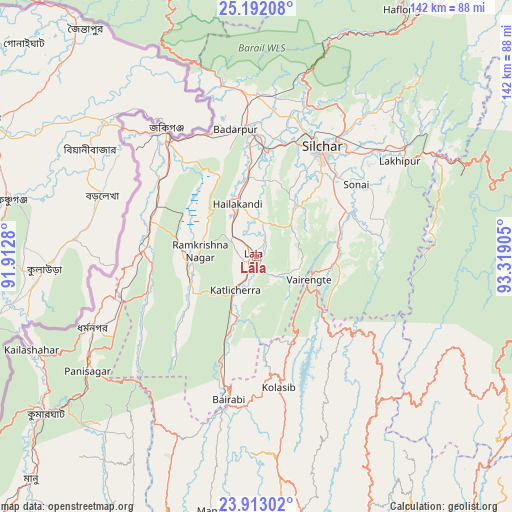
Lāla GPS coordinates[2]
24° 33' 15.048" North, 92° 36' 57.312" East
| Map corner | latitude | longitude |
|---|---|---|
| Upper-left | 25.19208°, | 91.9128° |
| Center: | 24.55418°, | 92.61592° |
| Lower-right: | 23.91302°, | 93.31905° |
| Map W x H: | 142.2×142.2 km | = 88.4×88.4mi |
| max Lat: | 34.9274° ⇑39.1% North |
| Lāla: | 24.55418° |
| min Lat: | ⇓60.9% South 8.09008° |
| min Long | Lāla | max Long |
| 68.82655° | 92.61592° | 96.81° |
| W 97.4%⇐ | ⇒2.6% E |
Elevation
Elevation of Lāla is 34 m = 112 ft, and this is 261.6 m = 858 ft below average elevation for this country.
| Max E: |
3681 m = 12077 ft | 83.9% |
| Avg. | 295.6 m = 970 ft | |
| Lāla | 34 m = 112 ft | |
Min E: |
1 m = 3 ft | 16.1% |
See also: India elevation on elevation.city.
Geographical zone
Lāla is located in North temperate zone (between Tropic of Cancer and the Arctic Circle). Distance of this Northern Tropic circle is 124.2 km =77.2 mi to South.| Distance of | km | miles | from Lāla |
|---|---|---|---|
| North Pole | 7276.9 | 4521.7 | to North |
| Arctic Circle | 4671 | 2902.4 | to North |
| Tropic Cancer | 124.2 | 77.2 | to South |
| Equator | 2730.2 | 1696.5 | to South |


Nearby cities:
15 places around Lāla: (largest is in red/bold)
• Badarpur
35 km =21.7 mi,  356°
356°
• Darlawn
67.8 km =42.1 mi,  152°
152°
• Dharmanagar
50 km =31.1 mi,  245°
245°
• Hailākāndi
15.5 km =9.6 mi,  338°
338°
• Hāflong
79.1 km =49.2 mi,  30°
30°
• Jiribam
58.2 km =36.2 mi,  61°
61°
• Kailāshahar
66.7 km =41.4 mi, 248°
• Karīmganj
43.8 km =27.2 mi,  323°
323°
• Kolasib
37.3 km =23.2 mi,  170°
170°
• Lakhipur
47.8 km =29.7 mi, 56°
• Mamit
70.9 km =44.1 mi,  190°
190°
• Pherzawl
66.5 km =41.3 mi,  119°
119°
• Sairang
82.8 km =51.4 mi,  177°
177°
• Silchar
35.5 km =22.1 mi, 31°
• Sāitlaw
64.9 km =40.3 mi, 183°
Sources, notices
• [Note1] Compared only with cities in India existing in our database
• [Src1] Map data: © OpenStreetMap contributors (CC-BY-SA)
• [Src2] Other city data from geonames.org with taken over terms of usage.
• [Src3] Geographical zone / Annual Mean Temperature by Robert A. Rohde @ Wikipedia
