Darlawn geodata
Darlawn (Mizoram) is a populated place; located in India in Asia/Kolkata (GMT+5.5) time zone. With population of 3,962 people, there are 3381 cities with bigger population in this country. Compared to other cities in India, 58.2% of cities are located further ↓South; 97.8% of cities are located further ←West and 96.6% of cities have lower elevation than Darlawn. Note1


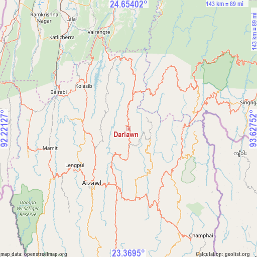
Darlawn GPS coordinates[2]
24° 0' 48.096" North, 92° 55' 27.804" East
| Map corner | latitude | longitude |
|---|---|---|
| Upper-left | 24.65402°, | 92.22127° |
| Center: | 24.01336°, | 92.92439° |
| Lower-right: | 23.3695°, | 93.62752° |
| Map W x H: | 142.8×142.8 km | = 88.7×88.7mi |
| max Lat: | 34.9274° ⇑41.8% North |
| Darlawn: | 24.01336° |
| min Lat: | ⇓58.2% South 8.09008° |
| min Long | Darlawn | max Long |
| 68.82655° | 92.92439° | 96.81° |
| W 97.8%⇐ | ⇒2.2% E |
Elevation
Elevation of Darlawn is 1119 m = 3671 ft, and this is 823.4 m = 2701 ft above average elevation for this country.
| Max E: |
3681 m = 12077 ft | 3.4% |
| Darlawn | 1119 m 3671 ft | |
| Avg. | 295.6 m = 970 ft | |
Min E: |
1 m = 3 ft | 96.6% |
See also: India elevation on elevation.city.
Geographical zone
Darlawn is located in North temperate zone (between Tropic of Cancer and the Arctic Circle). Distance of this Northern Tropic circle is 64.1 km =39.8 mi to South.| Distance of | km | miles | from Darlawn |
|---|---|---|---|
| North Pole | 7337 | 4559 | to North |
| Arctic Circle | 4731.1 | 2939.8 | to North |
| Tropic Cancer | 64.1 | 39.8 | to South |
| Equator | 2670 | 1659.1 | to South |


Nearby cities:
15 places around Darlawn: (largest is in red/bold)
• Aizawl
38 km =23.6 mi,  213°
213°
• Churāchāndpur
83.6 km =51.9 mi,  64°
64°
• Dharmanagar
86.3 km =53.6 mi,  297°
297°
• Hailākāndi
83.2 km =51.7 mi,  333°
333°
• Jiribam
90.2 km =56 mi,  12°
12°
• Khawhai
73.6 km =45.7 mi,  163°
163°
• Kolasib
34.2 km =21.3 mi,  313°
313°
• Lakhipur
87.1 km =54.1 mi, 5°
• Lāla
67.8 km =42.1 mi, 332°
• Mamit
45.2 km =28.1 mi,  257°
257°
• Pherzawl
38.5 km =23.9 mi,  44°
44°
• Sairang
35.7 km =22.2 mi,  230°
230°
• Serchhīp
80.5 km =50 mi,  185°
185°
• Sāitlaw
35.8 km =22.2 mi, 262°
• Thenzawl
79.5 km =49.4 mi, 192°
Sources, notices
• [Note1] Compared only with cities in India existing in our database
• [Src1] Map data: © OpenStreetMap contributors (CC-BY-SA)
• [Src2] Other city data from geonames.org with taken over terms of usage.
• [Src3] Geographical zone / Annual Mean Temperature by Robert A. Rohde @ Wikipedia
