Hailākāndi geodata
Hailākāndi (Assam) is a populated place; located in India in Asia/Kolkata (GMT+5.5) time zone. With population of 31,031 people, there are 1395 cities with bigger population in this country. Compared to other cities in India, 61.7% of cities are located further ↓South; 97.3% of cities are located further ←West and 85.1% of cities have higher elevation than Hailākāndi. Note1


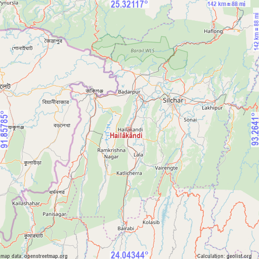
Hailākāndi GPS coordinates[2]
24° 41' 2.184" North, 92° 33' 39.492" East
| Map corner | latitude | longitude |
|---|---|---|
| Upper-left | 25.32117°, | 91.85785° |
| Center: | 24.68394°, | 92.56097° |
| Lower-right: | 24.04344°, | 93.2641° |
| Map W x H: | 142.1×142.1 km | = 88.3×88.3mi |
| max Lat: | 34.9274° ⇑38.3% North |
| Hailākāndi: | 24.68394° |
| min Lat: | ⇓61.7% South 8.09008° |
| min Long | Hailākāndi | max Long |
| 68.82655° | 92.56097° | 96.81° |
| W 97.3%⇐ | ⇒2.7% E |
Elevation
Elevation of Hailākāndi is 30 m = 98 ft, and this is 265.6 m = 871 ft below average elevation for this country.
| Max E: |
3681 m = 12077 ft | 85.1% |
| Avg. | 295.6 m = 970 ft | |
| Hailākāndi | 30 m = 98 ft | |
Min E: |
1 m = 3 ft | 14.9% |
See also: India elevation on elevation.city.
Geographical zone
Hailākāndi is located in North temperate zone (between Tropic of Cancer and the Arctic Circle). Distance of this Northern Tropic circle is 138.7 km =86.2 mi to South.| Distance of | km | miles | from Hailākāndi |
|---|---|---|---|
| North Pole | 7262.5 | 4512.7 | to North |
| Arctic Circle | 4656.6 | 2893.5 | to North |
| Tropic Cancer | 138.7 | 86.2 | to South |
| Equator | 2744.6 | 1705.4 | to South |


Nearby cities:
15 places around Hailākāndi: (largest is in red/bold)
• Badarpur
20.8 km =12.9 mi,  9°
9°
• Darlawn
83.2 km =51.7 mi,  153°
153°
• Dharmanagar
53.2 km =33.1 mi,  228°
228°
• Hāflong
70.5 km =43.8 mi,  40°
40°
• Jiribam
58.2 km =36.2 mi,  76°
76°
• Kailāshahar
68.6 km =42.6 mi,  235°
235°
• Karīmganj
29.2 km =18.1 mi,  314°
314°
• Khliehriat
77.4 km =48.1 mi,  345°
345°
• Kolasib
52.5 km =32.6 mi,  166°
166°
• Lakhipur
46.8 km =29.1 mi, 75°
• Lāla
15.5 km =9.6 mi,  158°
158°
• Mahur
78.6 km =48.8 mi,  45°
45°
• Pherzawl
79 km =49.1 mi,  126°
126°
• Silchar
28.7 km =17.8 mi,  56°
56°
• Sāitlaw
79.2 km =49.2 mi,  179°
179°
Sources, notices
• [Note1] Compared only with cities in India existing in our database
• [Src1] Map data: © OpenStreetMap contributors (CC-BY-SA)
• [Src2] Other city data from geonames.org with taken over terms of usage.
• [Src3] Geographical zone / Annual Mean Temperature by Robert A. Rohde @ Wikipedia
