Karīmganj geodata
Karīmganj (Assam) is a populated place; located in India in Asia/Kolkata (GMT+5.5) time zone. With population of 55,290 people, there are 804 cities with bigger population in this country. Compared to other cities in India, 62.8% of cities are located further ↓South; 97.1% of cities are located further ←West and 86.8% of cities have higher elevation than Karīmganj. Note1


Karīmganj GPS coordinates[2]
24° 52' 9.084" North, 92° 21' 19.548" East
| Map corner | latitude | longitude |
|---|---|---|
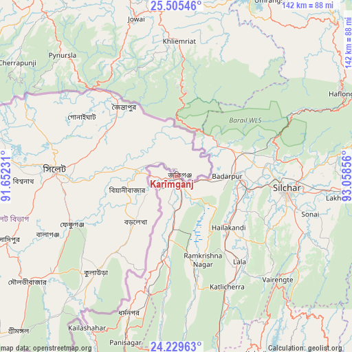
| Upper-left | 25.50546°, | 91.65231° |
| Center: | 24.86919°, | 92.35543° |
| Lower-right: | 24.22963°, | 93.05856° |
| Map W x H: | 141.9×141.9 km | = 88.2×88.2mi |
| max Lat: | 34.9274° ⇑37.2% North |
| Karīmganj: | 24.86919° |
| min Lat: | ⇓62.8% South 8.09008° |
| min Long | Karīmganj | max Long |
| 68.82655° | 92.35543° | 96.81° |
| W 97.1%⇐ | ⇒2.9% E |
Elevation
Elevation of Karīmganj is 25 m = 82 ft, and this is 270.6 m = 888 ft below average elevation for this country.
| Max E: |
3681 m = 12077 ft | 86.8% |
| Avg. | 295.6 m = 970 ft | |
| Karīmganj | 25 m = 82 ft | |
Min E: |
1 m = 3 ft | 13.2% |
See also: Karīmganj elevation on elevation.city.
Geographical zone
Karīmganj is located in North temperate zone (between Tropic of Cancer and the Arctic Circle). Distance of this Northern Tropic circle is 159.3 km =99 mi to South.| Distance of | km | miles | from Karīmganj |
|---|---|---|---|
| North Pole | 7241.9 | 4499.9 | to North |
| Arctic Circle | 4636 | 2880.7 | to North |
| Tropic Cancer | 159.3 | 99 | to South |
| Equator | 2765.2 | 1718.2 | to South |


Nearby cities:
15 places around Karīmganj: (largest is in red/bold)
• Badarpur
24.3 km =15.1 mi,  90°
90°
• Cherrapunji
81.9 km =50.9 mi,  305°
305°
• Dharmanagar
59 km =36.7 mi,  198°
198°
• Hailākāndi
29.2 km =18.1 mi,  134°
134°
• Hāflong
74.4 km =46.2 mi,  63°
63°
• Jiribam
77.6 km =48.2 mi,  95°
95°
• Kailāshahar
69.5 km =43.2 mi,  210°
210°
• Kamalpur
91.6 km =56.9 mi,  215°
215°
• Khliehriat
54.3 km =33.7 mi,  1°
1°
• Kolasib
78.8 km =49 mi,  155°
155°
• Lakhipur
66.5 km =41.3 mi, 97°
• Lāla
43.8 km =27.2 mi,  143°
143°
• Mahur
84 km =52.2 mi,  65°
65°
• Shillong
91.2 km =56.7 mi,  328°
328°
• Silchar
44.9 km =27.9 mi, 95°
Sources, notices
• [Note1] Compared only with cities in India existing in our database
• [Src1] Map data: © OpenStreetMap contributors (CC-BY-SA)
• [Src2] Other city data from geonames.org with taken over terms of usage.
• [Src3] Geographical zone / Annual Mean Temperature by Robert A. Rohde @ Wikipedia
