Kūd geodata
Kūd (Jammu and Kashmir) is a populated place; located in India in Asia/Kolkata (GMT+5.5) time zone. With population of 1,242 people, there are 3457 cities with bigger population in this country. Compared to other cities in India, 98.9% of cities are located further ↓South; 80.3% of cities are located further →East and 99% of cities have lower elevation than Kūd. Note1


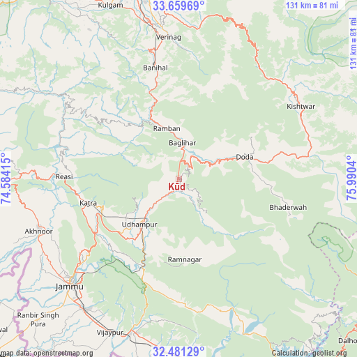
Kūd GPS coordinates[2]
33° 4' 20.856" North, 75° 17' 14.172" East
| Map corner | latitude | longitude |
|---|---|---|
| Upper-left | 33.65969°, | 74.58415° |
| Center: | 33.07246°, | 75.28727° |
| Lower-right: | 32.48129°, | 75.9904° |
| Map W x H: | 131×131 km | = 81.4×81.4mi |
| max Lat: | 34.9274° ⇑1.1% North |
| Kūd: | 33.07246° |
| min Lat: | ⇓98.9% South 8.09008° |
| min Long | Kūd | max Long |
| 68.82655° | 75.28727° | 96.81° |
| W 19.7%⇐ | ⇒80.3% E |
Elevation
Elevation of Kūd is 1792 m = 5879 ft, and this is 1496.4 m = 4909 ft above average elevation for this country.
| Max E: |
3681 m = 12077 ft | 1% |
| Kūd | 1792 m 5879 ft | |
| Avg. | 295.6 m = 970 ft | |
Min E: |
1 m = 3 ft | 99% |
See also: India elevation on elevation.city.
Geographical zone
Kūd is located in North temperate zone (between Tropic of Cancer and the Arctic Circle). Distance of this Northern Tropic circle is 1071.4 km =665.7 mi to South.| Distance of | km | miles | from Kūd |
|---|---|---|---|
| North Pole | 6329.7 | 3933.1 | to North |
| Arctic Circle | 3723.9 | 2313.9 | to North |
| Tropic Cancer | 1071.4 | 665.7 | to South |
| Equator | 3677.3 | 2285 | to South |


Nearby cities:
15 places around Kūd: (largest is in red/bold)
• Akhnūr
56.5 km =35.1 mi,  246°
246°
• Banihāl
41.3 km =25.7 mi,  348°
348°
• Batoti
5.5 km =3.4 mi,  21°
21°
• Bhadarwāh
41.4 km =25.7 mi,  104°
104°
• Doda
25.7 km =16 mi,  70°
70°
• Gho Brāhmanān de
65.3 km =40.6 mi,  208°
208°
• Jammu
54.1 km =33.6 mi,  226°
226°
• Katra
34.3 km =21.3 mi, 254°
• Kishtwār
52.1 km =32.4 mi,  59°
59°
• Qāzigund
64.3 km =40 mi, 347°
• Riāsi
42.4 km =26.3 mi,  271°
271°
• Rāmban
19.5 km =12.1 mi, 345°
• Rāmnagar
29.6 km =18.4 mi,  175°
175°
• Sāmba
58.8 km =36.5 mi,  195°
195°
• Udhampur
21.7 km =13.5 mi,  220°
220°
Sources, notices
• [Note1] Compared only with cities in India existing in our database
• [Src1] Map data: © OpenStreetMap contributors (CC-BY-SA)
• [Src2] Other city data from geonames.org with taken over terms of usage.
• [Src3] Geographical zone / Annual Mean Temperature by Robert A. Rohde @ Wikipedia
