Kishtwār geodata
Kishtwār (Jammu and Kashmir) is a populated place; located in India in Asia/Kolkata (GMT+5.5) time zone. With population of 20,553 people, there are 1997 cities with bigger population in this country. Compared to other cities in India, 99.1% of cities are located further ↓South; 76.1% of cities are located further →East and 98.5% of cities have lower elevation than Kishtwār. Note1


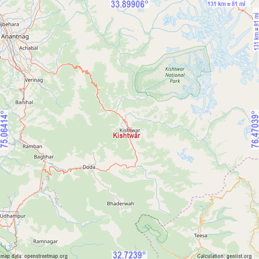
Kishtwār GPS coordinates[2]
33° 18' 48.456" North, 75° 46' 2.136" East
| Map corner | latitude | longitude |
|---|---|---|
| Upper-left | 33.89906°, | 75.06414° |
| Center: | 33.31346°, | 75.76726° |
| Lower-right: | 32.7239°, | 76.47039° |
| Map W x H: | 130.7×130.7 km | = 81.2×81.2mi |
| max Lat: | 34.9274° ⇑0.9% North |
| Kishtwār: | 33.31346° |
| min Lat: | ⇓99.1% South 8.09008° |
| min Long | Kishtwār | max Long |
| 68.82655° | 75.76726° | 96.81° |
| W 23.9%⇐ | ⇒76.1% E |
Elevation
Elevation of Kishtwār is 1642 m = 5387 ft, and this is 1346.4 m = 4417 ft above average elevation for this country.
| Max E: |
3681 m = 12077 ft | 1.5% |
| Kishtwār | 1642 m 5387 ft | |
| Avg. | 295.6 m = 970 ft | |
Min E: |
1 m = 3 ft | 98.5% |
See also: India elevation on elevation.city.
Geographical zone
Kishtwār is located in North temperate zone (between Tropic of Cancer and the Arctic Circle). Distance of this Northern Tropic circle is 1098.2 km =682.4 mi to South.| Distance of | km | miles | from Kishtwār |
|---|---|---|---|
| North Pole | 6303 | 3916.5 | to North |
| Arctic Circle | 3697.1 | 2297.3 | to North |
| Tropic Cancer | 1098.2 | 682.4 | to South |
| Equator | 3704.1 | 2301.6 | to South |


Nearby cities:
15 places around Kishtwār: (largest is in red/bold)
• Anantnag
73.4 km =45.6 mi,  309°
309°
• Banihāl
54.7 km =34 mi,  284°
284°
• Batoti
47.8 km =29.7 mi,  243°
243°
• Bhadarwāh
37.4 km =23.2 mi,  187°
187°
• Bijbehara
81.2 km =50.5 mi, 311°
• Dalhousie
86.3 km =53.6 mi,  168°
168°
• Doda
27.4 km =17 mi,  228°
228°
• Katra
85.6 km =53.2 mi,  245°
245°
• Kulgam
78.5 km =48.8 mi,  297°
297°
• Kūd
52.1 km =32.4 mi, 239°
• Pahlgām
88.4 km =54.9 mi,  332°
332°
• Qāzigund
68.3 km =42.4 mi, 301°
• Rāmban
50.1 km =31.1 mi,  260°
260°
• Rāmnagar
70.5 km =43.8 mi,  217°
217°
• Udhampur
73 km =45.4 mi, 233°
Sources, notices
• [Note1] Compared only with cities in India existing in our database
• [Src1] Map data: © OpenStreetMap contributors (CC-BY-SA)
• [Src2] Other city data from geonames.org with taken over terms of usage.
• [Src3] Geographical zone / Annual Mean Temperature by Robert A. Rohde @ Wikipedia
