Bhadarwāh geodata
Bhadarwāh (Jammu and Kashmir) is a populated place; located in India in Asia/Kolkata (GMT+5.5) time zone. With population of 13,429 people, there are 2618 cities with bigger population in this country. Compared to other cities in India, 98.9% of cities are located further ↓South; 76.5% of cities are located further →East and 98.5% of cities have lower elevation than Bhadarwāh. Note1


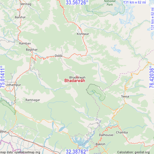
Bhadarwāh GPS coordinates[2]
32° 58' 45.876" North, 75° 43' 2.028" East
| Map corner | latitude | longitude |
|---|---|---|
| Upper-left | 33.56726°, | 75.01411° |
| Center: | 32.97941°, | 75.71723° |
| Lower-right: | 32.38762°, | 76.42036° |
| Map W x H: | 131.2×131.2 km | = 81.5×81.5mi |
| max Lat: | 34.9274° ⇑1.1% North |
| Bhadarwāh: | 32.97941° |
| min Lat: | ⇓98.9% South 8.09008° |
| min Long | Bhadarwāh | max Long |
| 68.82655° | 75.71723° | 96.81° |
| W 23.5%⇐ | ⇒76.5% E |
Elevation
Elevation of Bhadarwāh is 1636 m = 5367 ft, and this is 1340.4 m = 4398 ft above average elevation for this country.
| Max E: |
3681 m = 12077 ft | 1.5% |
| Bhadarwāh | 1636 m 5367 ft | |
| Avg. | 295.6 m = 970 ft | |
Min E: |
1 m = 3 ft | 98.5% |
See also: India elevation on elevation.city.
Geographical zone
Bhadarwāh is located in North temperate zone (between Tropic of Cancer and the Arctic Circle). Distance of this Northern Tropic circle is 1061 km =659.3 mi to South.| Distance of | km | miles | from Bhadarwāh |
|---|---|---|---|
| North Pole | 6340.1 | 3939.6 | to North |
| Arctic Circle | 3734.2 | 2320.3 | to North |
| Tropic Cancer | 1061 | 659.3 | to South |
| Equator | 3667 | 2278.6 | to South |


Nearby cities:
15 places around Bhadarwāh: (largest is in red/bold)
• Bakloh
58.7 km =36.5 mi,  161°
161°
• Banihāl
70.2 km =43.6 mi,  316°
316°
• Batoti
41.1 km =25.5 mi,  292°
292°
• Chamba
60.7 km =37.7 mi,  140°
140°
• Chowari
66.8 km =41.5 mi, 155°
• Chuāri Khās
67.1 km =41.7 mi, 155°
• Dalhousie
52.1 km =32.4 mi, 155°
• Doda
24.6 km =15.3 mi, 320°
• Hirānagar
71.7 km =44.6 mi,  215°
215°
• Kathua
70.2 km =43.6 mi,  194°
194°
• Kishtwār
37.4 km =23.2 mi,  7°
7°
• Kūd
41.4 km =25.7 mi,  284°
284°
• Rāmban
53.6 km =33.3 mi,  303°
303°
• Rāmnagar
42.5 km =26.4 mi,  243°
243°
• Udhampur
54.6 km =33.9 mi,  263°
263°
Sources, notices
• [Note1] Compared only with cities in India existing in our database
• [Src1] Map data: © OpenStreetMap contributors (CC-BY-SA)
• [Src2] Other city data from geonames.org with taken over terms of usage.
• [Src3] Geographical zone / Annual Mean Temperature by Robert A. Rohde @ Wikipedia
