Doda geodata
Doda (Jammu and Kashmir) is a populated place; located in India in Asia/Kolkata (GMT+5.5) time zone. With population of 17,748 people, there are 2219 cities with bigger population in this country. Compared to other cities in India, 99% of cities are located further ↓South; 78.1% of cities are located further →East and 96.9% of cities have lower elevation than Doda. Note1


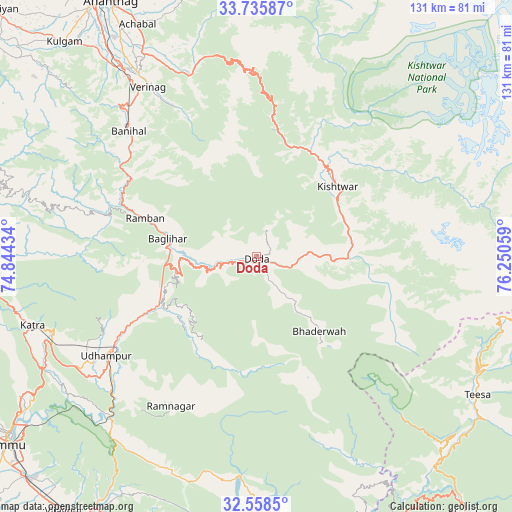
Doda GPS coordinates[2]
33° 8' 56.976" North, 75° 32' 50.856" East
| Map corner | latitude | longitude |
|---|---|---|
| Upper-left | 33.73587°, | 74.84434° |
| Center: | 33.14916°, | 75.54746° |
| Lower-right: | 32.5585°, | 76.25059° |
| Map W x H: | 130.9×130.9 km | = 81.3×81.3mi |
| max Lat: | 34.9274° ⇑1% North |
| Doda: | 33.14916° |
| min Lat: | ⇓99% South 8.09008° |
| min Long | Doda | max Long |
| 68.82655° | 75.54746° | 96.81° |
| W 21.9%⇐ | ⇒78.1% E |
Elevation
Elevation of Doda is 1191 m = 3907 ft, and this is 895.4 m = 2938 ft above average elevation for this country.
| Max E: |
3681 m = 12077 ft | 3.1% |
| Doda | 1191 m 3907 ft | |
| Avg. | 295.6 m = 970 ft | |
Min E: |
1 m = 3 ft | 96.9% |
See also: India elevation on elevation.city.
Geographical zone
Doda is located in North temperate zone (between Tropic of Cancer and the Arctic Circle). Distance of this Northern Tropic circle is 1079.9 km =671 mi to South.| Distance of | km | miles | from Doda |
|---|---|---|---|
| North Pole | 6321.2 | 3927.8 | to North |
| Arctic Circle | 3715.3 | 2308.6 | to North |
| Tropic Cancer | 1079.9 | 671 | to South |
| Equator | 3685.8 | 2290.2 | to South |


Nearby cities:
15 places around Doda: (largest is in red/bold)
• Anantnag
74.2 km =46.1 mi,  330°
330°
• Banihāl
45.6 km =28.3 mi,  314°
314°
• Batoti
22.5 km =14 mi,  261°
261°
• Bhadarwāh
24.6 km =15.3 mi,  140°
140°
• Dalhousie
76.1 km =47.3 mi,  150°
150°
• Katra
60 km =37.3 mi,  253°
253°
• Kishtwār
27.4 km =17 mi,  48°
48°
• Kulgam
73.7 km =45.8 mi,  318°
318°
• Kūd
25.7 km =16 mi, 250°
• Qāzigund
66.1 km =41.1 mi, 325°
• Riāsi
67 km =41.6 mi, 263°
• Rāmban
30.9 km =19.2 mi,  289°
289°
• Rāmnagar
43.9 km =27.3 mi,  210°
210°
• Sāmba
76.5 km =47.5 mi, 211°
• Udhampur
45.8 km =28.5 mi,  236°
236°
Sources, notices
• [Note1] Compared only with cities in India existing in our database
• [Src1] Map data: © OpenStreetMap contributors (CC-BY-SA)
• [Src2] Other city data from geonames.org with taken over terms of usage.
• [Src3] Geographical zone / Annual Mean Temperature by Robert A. Rohde @ Wikipedia
