Banihāl geodata
Banihāl (Jammu and Kashmir) is a populated place; located in India in Asia/Kolkata (GMT+5.5) time zone. With population of 3,278 people, there are 3404 cities with bigger population in this country. Compared to other cities in India, 99.2% of cities are located further ↓South; 81% of cities are located further →East and 98.6% of cities have lower elevation than Banihāl. Note1


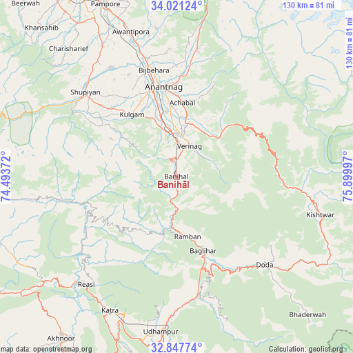
Banihāl GPS coordinates[2]
33° 26' 11.292" North, 75° 11' 48.624" East
| Map corner | latitude | longitude |
|---|---|---|
| Upper-left | 34.02124°, | 74.49372° |
| Center: | 33.43647°, | 75.19684° |
| Lower-right: | 32.84774°, | 75.89997° |
| Map W x H: | 130.5×130.5 km | = 81.1×81.1mi |
| max Lat: | 34.9274° ⇑0.8% North |
| Banihāl: | 33.43647° |
| min Lat: | ⇓99.2% South 8.09008° |
| min Long | Banihāl | max Long |
| 68.82655° | 75.19684° | 96.81° |
| W 19%⇐ | ⇒81% E |
Elevation
Elevation of Banihāl is 1649 m = 5410 ft, and this is 1353.4 m = 4440 ft above average elevation for this country.
| Max E: |
3681 m = 12077 ft | 1.4% |
| Banihāl | 1649 m 5410 ft | |
| Avg. | 295.6 m = 970 ft | |
Min E: |
1 m = 3 ft | 98.6% |
See also: India elevation on elevation.city.
Geographical zone
Banihāl is located in North temperate zone (between Tropic of Cancer and the Arctic Circle). Distance of this Northern Tropic circle is 1111.9 km =690.9 mi to South.| Distance of | km | miles | from Banihāl |
|---|---|---|---|
| North Pole | 6289.3 | 3908 | to North |
| Arctic Circle | 3683.4 | 2288.8 | to North |
| Tropic Cancer | 1111.9 | 690.9 | to South |
| Equator | 3717.8 | 2310.1 | to South |


Nearby cities:
15 places around Banihāl: (largest is in red/bold)
• Anantnag
33 km =20.5 mi,  353°
353°
• Awantipur
56.3 km =35 mi,  342°
342°
• Batoti
36.9 km =22.9 mi,  163°
163°
• Bijbehara
40.6 km =25.2 mi, 348°
• Doda
45.6 km =28.3 mi,  134°
134°
• Katra
55.3 km =34.4 mi,  206°
206°
• Kishtwār
54.7 km =34 mi,  104°
104°
• Kulgam
28.4 km =17.6 mi,  324°
324°
• Kūd
41.3 km =25.7 mi,  168°
168°
• Pulwama
55.9 km =34.7 mi,  330°
330°
• Qāzigund
23 km =14.3 mi, 347°
• Riāsi
52 km =32.3 mi,  220°
220°
• Rāmban
21.8 km =13.5 mi, 170°
• Shupīyan
45.9 km =28.5 mi,  312°
312°
• Trāl
55.1 km =34.2 mi, 352°
Sources, notices
• [Note1] Compared only with cities in India existing in our database
• [Src1] Map data: © OpenStreetMap contributors (CC-BY-SA)
• [Src2] Other city data from geonames.org with taken over terms of usage.
• [Src3] Geographical zone / Annual Mean Temperature by Robert A. Rohde @ Wikipedia
