Dalhousie geodata
Dalhousie (Himachal Pradesh) is a populated place; located in India in Asia/Kolkata (GMT+5.5) time zone. With population of 7,601 people, there are 3161 cities with bigger population in this country. Compared to other cities in India, 98.5% of cities are located further ↓South; 74.1% of cities are located further →East and 98.8% of cities have lower elevation than Dalhousie. Note1


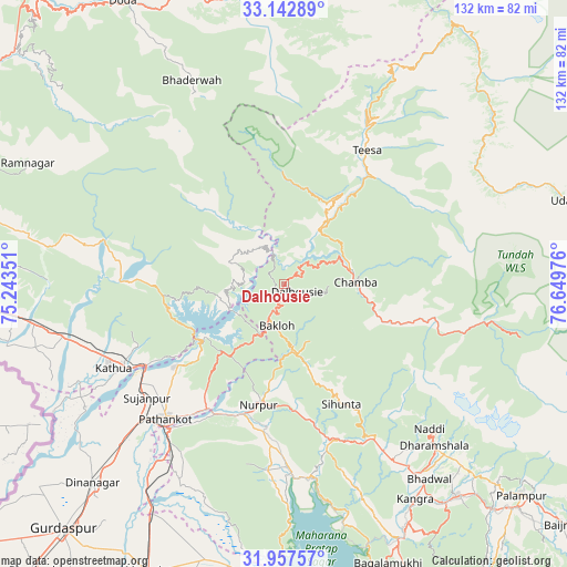
Dalhousie GPS coordinates[2]
32° 33' 7.884" North, 75° 56' 47.868" East
| Map corner | latitude | longitude |
|---|---|---|
| Upper-left | 33.14289°, | 75.24351° |
| Center: | 32.55219°, | 75.94663° |
| Lower-right: | 31.95757°, | 76.64976° |
| Map W x H: | 131.8×131.8 km | = 81.9×81.9mi |
| max Lat: | 34.9274° ⇑1.5% North |
| Dalhousie: | 32.55219° |
| min Lat: | ⇓98.5% South 8.09008° |
| min Long | Dalhousie | max Long |
| 68.82655° | 75.94663° | 96.81° |
| W 25.9%⇐ | ⇒74.1% E |
Elevation
Elevation of Dalhousie is 1697 m = 5568 ft, and this is 1401.4 m = 4598 ft above average elevation for this country.
| Max E: |
3681 m = 12077 ft | 1.2% |
| Dalhousie | 1697 m 5568 ft | |
| Avg. | 295.6 m = 970 ft | |
Min E: |
1 m = 3 ft | 98.8% |
See also: India elevation on elevation.city.
Geographical zone
Dalhousie is located in North temperate zone (between Tropic of Cancer and the Arctic Circle). Distance of this Northern Tropic circle is 1013.5 km =629.8 mi to South.| Distance of | km | miles | from Dalhousie |
|---|---|---|---|
| North Pole | 6387.6 | 3969.1 | to North |
| Arctic Circle | 3781.7 | 2349.8 | to North |
| Tropic Cancer | 1013.5 | 629.8 | to South |
| Equator | 3619.5 | 2249.1 | to South |


Nearby cities:
15 places around Dalhousie: (largest is in red/bold)
• Bakloh
8.5 km =5.3 mi,  197°
197°
• Bhadarwāh
52.1 km =32.4 mi,  335°
335°
• Chamba
16.9 km =10.5 mi,  88°
88°
• Chowari
14.7 km =9.1 mi,  155°
155°
• Chuāri Khās
14.9 km =9.3 mi,  154°
154°
• Daulatpur
62.6 km =38.9 mi, 151°
• Dharamsala
50.9 km =31.6 mi,  136°
136°
• Dīnānagar
64.1 km =39.8 mi,  223°
223°
• Kathua
44.4 km =27.6 mi,  242°
242°
• Kotla
34.6 km =21.5 mi,  166°
166°
• Kāngar
59.2 km =36.8 mi, 149°
• Nagrota
56.7 km =35.2 mi, 166°
• Parol
53.3 km =33.1 mi, 244°
• Pathānkot
41.4 km =25.7 mi, 221°
• Yol
49.1 km =30.5 mi, 151°
Sources, notices
• [Note1] Compared only with cities in India existing in our database
• [Src1] Map data: © OpenStreetMap contributors (CC-BY-SA)
• [Src2] Other city data from geonames.org with taken over terms of usage.
• [Src3] Geographical zone / Annual Mean Temperature by Robert A. Rohde @ Wikipedia
