Kamalpur geodata
Kamalpur (Tripura) is a populated place; located in India in Asia/Kolkata (GMT+5.5) time zone. With population of 5,508 people, there are 3320 cities with bigger population in this country. Compared to other cities in India, 59% of cities are located further ↓South; 96.8% of cities are located further ←West and 82.1% of cities have higher elevation than Kamalpur. Note1


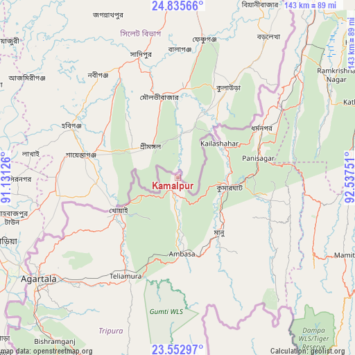
Kamalpur GPS coordinates[2]
24° 11' 45.348" North, 91° 50' 3.768" East
| Map corner | latitude | longitude |
|---|---|---|
| Upper-left | 24.83566°, | 91.13126° |
| Center: | 24.19593°, | 91.83438° |
| Lower-right: | 23.55297°, | 92.53751° |
| Map W x H: | 142.6×142.6 km | = 88.6×88.6mi |
| max Lat: | 34.9274° ⇑41% North |
| Kamalpur: | 24.19593° |
| min Lat: | ⇓59% South 8.09008° |
| min Long | Kamalpur | max Long |
| 68.82655° | 91.83438° | 96.81° |
| W 96.8%⇐ | ⇒3.2% E |
Elevation
Elevation of Kamalpur is 40 m = 131 ft, and this is 255.6 m = 839 ft below average elevation for this country.
| Max E: |
3681 m = 12077 ft | 82.1% |
| Avg. | 295.6 m = 970 ft | |
| Kamalpur | 40 m = 131 ft | |
Min E: |
1 m = 3 ft | 17.9% |
See also: India elevation on elevation.city.
Geographical zone
Kamalpur is located in North temperate zone (between Tropic of Cancer and the Arctic Circle). Distance of this Northern Tropic circle is 84.4 km =52.4 mi to South.| Distance of | km | miles | from Kamalpur |
|---|---|---|---|
| North Pole | 7316.7 | 4546.4 | to North |
| Arctic Circle | 4710.8 | 2927.2 | to North |
| Tropic Cancer | 84.4 | 52.4 | to South |
| Equator | 2690.3 | 1671.7 | to South |


Nearby cities:
15 places around Kamalpur: (largest is in red/bold)
• Agartala
69.1 km =42.9 mi,  234°
234°
• Amarpur
76.6 km =47.6 mi,  193°
193°
• Barjala
80.6 km =50.1 mi,  217°
217°
• Bishramganj
82.4 km =51.2 mi, 217°
• Dharmanagar
38.7 km =24 mi,  60°
60°
• Hailākāndi
91.4 km =56.8 mi,  53°
53°
• Kailāshahar
22.9 km =14.2 mi, 48°
• Khowai
27.1 km =16.8 mi,  241°
241°
• Kolasib
85.7 km =53.3 mi,  87°
87°
• Lāla
88.6 km =55.1 mi, 63°
• Mamit
72.9 km =45.3 mi,  114°
114°
• Rānīr Bāzār
62.3 km =38.7 mi, 229°
• Sāitlaw
79.2 km =49.2 mi, 108°
• Udaipur
81.9 km =50.9 mi,  205°
205°
• Āmbāsa
29 km =18 mi,  175°
175°
Sources, notices
• [Note1] Compared only with cities in India existing in our database
• [Src1] Map data: © OpenStreetMap contributors (CC-BY-SA)
• [Src2] Other city data from geonames.org with taken over terms of usage.
• [Src3] Geographical zone / Annual Mean Temperature by Robert A. Rohde @ Wikipedia
