Jamūī geodata
Jamūī (Bihar) is a populated place; located in India in Asia/Kolkata (GMT+5.5) time zone. With population of 78,181 people, there are 558 cities with bigger population in this country. Compared to other cities in India, 63.1% of cities are located further ↓South; 87.6% of cities are located further ←West and 71% of cities have higher elevation than Jamūī. Note1


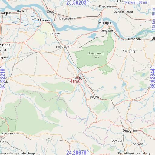
Jamūī GPS coordinates[2]
24° 55' 33.816" North, 86° 13' 31.116" East
| Map corner | latitude | longitude |
|---|---|---|
| Upper-left | 25.56203°, | 85.52219° |
| Center: | 24.92606°, | 86.22531° |
| Lower-right: | 24.28679°, | 86.92844° |
| Map W x H: | 141.8×141.8 km | = 88.1×88.1mi |
| max Lat: | 34.9274° ⇑36.9% North |
| Jamūī: | 24.92606° |
| min Lat: | ⇓63.1% South 8.09008° |
| min Long | Jamūī | max Long |
| 68.82655° | 86.22531° | 96.81° |
| W 87.6%⇐ | ⇒12.4% E |
Elevation
Elevation of Jamūī is 88 m = 289 ft, and this is 207.6 m = 681 ft below average elevation for this country.
| Max E: |
3681 m = 12077 ft | 71% |
| Avg. | 295.6 m = 970 ft | |
| Jamūī | 88 m = 289 ft | |
Min E: |
1 m = 3 ft | 29% |
See also: Jamūī elevation on elevation.city.
Geographical zone
Jamūī is located in North temperate zone (between Tropic of Cancer and the Arctic Circle). Distance of this Northern Tropic circle is 165.6 km =102.9 mi to South.| Distance of | km | miles | from Jamūī |
|---|---|---|---|
| North Pole | 7235.5 | 4495.9 | to North |
| Arctic Circle | 4629.7 | 2876.8 | to North |
| Tropic Cancer | 165.6 | 102.9 | to South |
| Equator | 2771.5 | 1722.1 | to South |


Nearby cities:
15 places around Jamūī: (largest is in red/bold)
• Asarganj
52.7 km =32.7 mi,  61°
61°
• Bar Bigha
59.3 km =36.8 mi,  303°
303°
• Barhiya
45.2 km =28.1 mi,  332°
332°
• Bariārpur
53.6 km =33.3 mi,  41°
41°
• Begusarai
55.5 km =34.5 mi,  350°
350°
• Dhanwār
62.4 km =38.8 mi,  203°
203°
• Jamālpur
50.5 km =31.4 mi,  31°
31°
• Jasidih
62.5 km =38.8 mi,  137°
137°
• Jhā-Jhā
23.2 km =14.4 mi, 138°
• Kharagpur
39.9 km =24.8 mi, 56°
• Luckeesarai
30.8 km =19.1 mi, 334°
• Mokameh
60.6 km =37.7 mi, 329°
• Monghyr
55.8 km =34.7 mi, 26°
• Sheikhpura
45.4 km =28.2 mi, 301°
• Wāris Alīganj
59.8 km =37.2 mi,  279°
279°
Sources, notices
• [Note1] Compared only with cities in India existing in our database
• [Src1] Map data: © OpenStreetMap contributors (CC-BY-SA)
• [Src2] Other city data from geonames.org with taken over terms of usage.
• [Src3] Geographical zone / Annual Mean Temperature by Robert A. Rohde @ Wikipedia
