Jhā-Jhā geodata
Jhā-Jhā (Bihar) is a populated place; located in India in Asia/Kolkata (GMT+5.5) time zone. With population of 38,624 people, there are 1138 cities with bigger population in this country. Compared to other cities in India, 62.2% of cities are located further ↓South; 87.9% of cities are located further ←West and 61.8% of cities have higher elevation than Jhā-Jhā. Note1


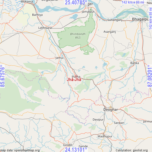
Jhā-Jhā GPS coordinates[2]
24° 46' 15.852" North, 86° 22' 43.968" East
| Map corner | latitude | longitude |
|---|---|---|
| Upper-left | 25.40785°, | 85.67576° |
| Center: | 24.77107°, | 86.37888° |
| Lower-right: | 24.13101°, | 87.08201° |
| Map W x H: | 142×142 km | = 88.2×88.2mi |
| max Lat: | 34.9274° ⇑37.8% North |
| Jhā-Jhā: | 24.77107° |
| min Lat: | ⇓62.2% South 8.09008° |
| min Long | Jhā-Jhā | max Long |
| 68.82655° | 86.37888° | 96.81° |
| W 87.9%⇐ | ⇒12.1% E |
Elevation
Elevation of Jhā-Jhā is 139 m = 456 ft, and this is 156.6 m = 514 ft below average elevation for this country.
| Max E: |
3681 m = 12077 ft | 61.8% |
| Avg. | 295.6 m = 970 ft | |
| Jhā-Jhā | 139 m = 456 ft | |
Min E: |
1 m = 3 ft | 38.2% |
See also: India elevation on elevation.city.
Geographical zone
Jhā-Jhā is located in North temperate zone (between Tropic of Cancer and the Arctic Circle). Distance of this Northern Tropic circle is 148.4 km =92.2 mi to South.| Distance of | km | miles | from Jhā-Jhā |
|---|---|---|---|
| North Pole | 7252.8 | 4506.7 | to North |
| Arctic Circle | 4646.9 | 2887.4 | to North |
| Tropic Cancer | 148.4 | 92.2 | to South |
| Equator | 2754.3 | 1711.4 | to South |


Nearby cities:
15 places around Jhā-Jhā: (largest is in red/bold)
• Amarpur
60.7 km =37.7 mi,  60°
60°
• Asarganj
52.3 km =32.5 mi,  36°
36°
• Barhiya
67.9 km =42.2 mi,  327°
327°
• Bariārpur
60.8 km =37.8 mi,  19°
19°
• Bānka
56.2 km =34.9 mi,  77°
77°
• Dhanwār
56.7 km =35.2 mi,  225°
225°
• Gīrīdīh
65.4 km =40.6 mi,  186°
186°
• Jamālpur
61.2 km =38 mi,  10°
10°
• Jamūī
23.2 km =14.4 mi,  318°
318°
• Jasidih
39.3 km =24.4 mi,  136°
136°
• Kharagpur
43.2 km =26.8 mi, 24°
• Luckeesarai
53.4 km =33.2 mi, 327°
• Madhupur
61.2 km =38 mi,  154°
154°
• Monghyr
67.8 km =42.1 mi, 8°
• Sheikhpura
68 km =42.3 mi,  307°
307°
Sources, notices
• [Note1] Compared only with cities in India existing in our database
• [Src1] Map data: © OpenStreetMap contributors (CC-BY-SA)
• [Src2] Other city data from geonames.org with taken over terms of usage.
• [Src3] Geographical zone / Annual Mean Temperature by Robert A. Rohde @ Wikipedia
