Harbatpur geodata
Harbatpur (Uttarakhand) is a populated place; located in India in Asia/Kolkata (GMT+5.5) time zone. With population of 9,478 people, there are 2996 cities with bigger population in this country. Compared to other cities in India, 94.2% of cities are located further ↓South; 54.5% of cities are located further →East and 79.3% of cities have lower elevation than Harbatpur. Note1


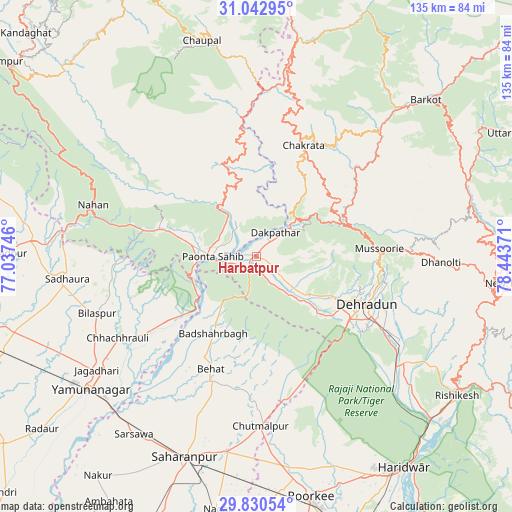
Harbatpur GPS coordinates[2]
30° 26' 19.068" North, 77° 44' 26.088" East
| Map corner | latitude | longitude |
|---|---|---|
| Upper-left | 31.04295°, | 77.03746° |
| Center: | 30.43863°, | 77.74058° |
| Lower-right: | 29.83054°, | 78.44371° |
| Map W x H: | 134.8×134.8 km | = 83.8×83.8mi |
| max Lat: | 34.9274° ⇑5.8% North |
| Harbatpur: | 30.43863° |
| min Lat: | ⇓94.2% South 8.09008° |
| min Long | Harbatpur | max Long |
| 68.82655° | 77.74058° | 96.81° |
| W 45.5%⇐ | ⇒54.5% E |
Elevation
Elevation of Harbatpur is 448 m = 1470 ft, and this is 152.4 m = 500 ft above average elevation for this country.
| Max E: |
3681 m = 12077 ft | 20.7% |
| Harbatpur | 448 m 1470 ft | |
| Avg. | 295.6 m = 970 ft | |
Min E: |
1 m = 3 ft | 79.3% |
See also: India elevation on elevation.city.
Geographical zone
Harbatpur is located in North temperate zone (between Tropic of Cancer and the Arctic Circle). Distance of this Northern Tropic circle is 778.5 km =483.7 mi to South.| Distance of | km | miles | from Harbatpur |
|---|---|---|---|
| North Pole | 6622.6 | 4115.1 | to North |
| Arctic Circle | 4016.7 | 2495.9 | to North |
| Tropic Cancer | 778.5 | 483.7 | to South |
| Equator | 3384.5 | 2103 | to South |


Nearby cities:
15 places around Harbatpur: (largest is in red/bold)
• Behat
32.1 km =19.9 mi,  202°
202°
• Bilāspur
44.4 km =27.6 mi,  250°
250°
• Būriya
48.1 km =29.9 mi,  229°
229°
• Chakrāta
31.7 km =19.7 mi,  21°
21°
• Chhachhrauli
42.4 km =26.3 mi,  239°
239°
• Chhutmalpur
45.2 km =28.1 mi,  178°
178°
• Clement Town
32.3 km =20.1 mi,  127°
127°
• Dehra Dūn
30.9 km =19.2 mi,  114°
114°
• Doiwāla
46.4 km =28.8 mi, 128°
• Jagādhri
51.7 km =32.1 mi, 234°
• Mussoorie
31.7 km =19.7 mi,  86°
86°
• Nāhan
44.8 km =27.8 mi,  287°
287°
• Pāonta Sāhib
11.1 km =6.9 mi,  268°
268°
• Rāipur
36.4 km =22.6 mi, 112°
• Vikāsnagar
4.6 km =2.9 mi,  41°
41°
Sources, notices
• [Note1] Compared only with cities in India existing in our database
• [Src1] Map data: © OpenStreetMap contributors (CC-BY-SA)
• [Src2] Other city data from geonames.org with taken over terms of usage.
• [Src3] Geographical zone / Annual Mean Temperature by Robert A. Rohde @ Wikipedia
