Hayuliang geodata
Hayuliang (Arunachal Pradesh) is a populated place; located in India in Asia/Kolkata (GMT+5.5) time zone. With population of 1,834 people, there are 3442 cities with bigger population in this country. Compared to other cities in India, 84.8% of cities are located further ↓South; 99.9% of cities are located further ←West and 85.7% of cities have lower elevation than Hayuliang. Note1


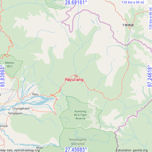
Hayuliang GPS coordinates[2]
28° 4' 22.836" North, 96° 32' 34.98" East
| Map corner | latitude | longitude |
|---|---|---|
| Upper-left | 28.69161°, | 95.83993° |
| Center: | 28.07301°, | 96.54305° |
| Lower-right: | 27.45083°, | 97.24618° |
| Map W x H: | 138×138 km | = 85.7×85.7mi |
| max Lat: | 34.9274° ⇑15.2% North |
| Hayuliang: | 28.07301° |
| min Lat: | ⇓84.8% South 8.09008° |
| min Long | Hayuliang | max Long |
| 68.82655° | 96.54305° | 96.81° |
| W 99.9%⇐ | ⇒0.099999999999994% E |
Elevation
Elevation of Hayuliang is 559 m = 1834 ft, and this is 263.4 m = 864 ft above average elevation for this country.
| Max E: |
3681 m = 12077 ft | 14.3% |
| Hayuliang | 559 m 1834 ft | |
| Avg. | 295.6 m = 970 ft | |
Min E: |
1 m = 3 ft | 85.7% |
See also: India elevation on elevation.city.
Geographical zone
Hayuliang is located in North temperate zone (between Tropic of Cancer and the Arctic Circle). Distance of this Northern Tropic circle is 515.5 km =320.3 mi to South.| Distance of | km | miles | from Hayuliang |
|---|---|---|---|
| North Pole | 6885.6 | 4278.5 | to North |
| Arctic Circle | 4279.7 | 2659.3 | to North |
| Tropic Cancer | 515.5 | 320.3 | to South |
| Equator | 3121.4 | 1939.5 | to South |


Nearby cities:
15 places around Hayuliang: (largest is in red/bold)
• Chābua
149.8 km =93.1 mi,  244°
244°
• Digboi
118.3 km =73.5 mi,  230°
230°
• Duliāgaon
144.4 km =89.7 mi, 237°
• Dum Duma
112 km =69.6 mi, 239°
• Hawai
32.8 km =20.4 mi,  129°
129°
• Khonsa
151.9 km =94.4 mi,  219°
219°
• Margherita
122.9 km =76.4 mi, 224°
• Mākum
126.9 km =78.9 mi, 239°
• Nahorkatiya
146.9 km =91.3 mi, 233°
• Namsai
80.5 km =50 mi, 236°
• Nāmrup
155.2 km =96.4 mi, 230°
• Pangin
153.2 km =95.2 mi,  275°
275°
• Pāsighāt
119.3 km =74.1 mi,  269°
269°
• Tezu
44.4 km =27.6 mi,  246°
246°
• Tinsukia
133.3 km =82.8 mi, 240°
Sources, notices
• [Note1] Compared only with cities in India existing in our database
• [Src1] Map data: © OpenStreetMap contributors (CC-BY-SA)
• [Src2] Other city data from geonames.org with taken over terms of usage.
• [Src3] Geographical zone / Annual Mean Temperature by Robert A. Rohde @ Wikipedia
