Gopāmau geodata
Gopāmau (Uttar Pradesh) is a populated place; located in India in Asia/Kolkata (GMT+5.5) time zone. With population of 13,581 people, there are 2606 cities with bigger population in this country. Compared to other cities in India, 82.1% of cities are located further ↓South; 70.3% of cities are located further ←West and 60.3% of cities have higher elevation than Gopāmau. Note1


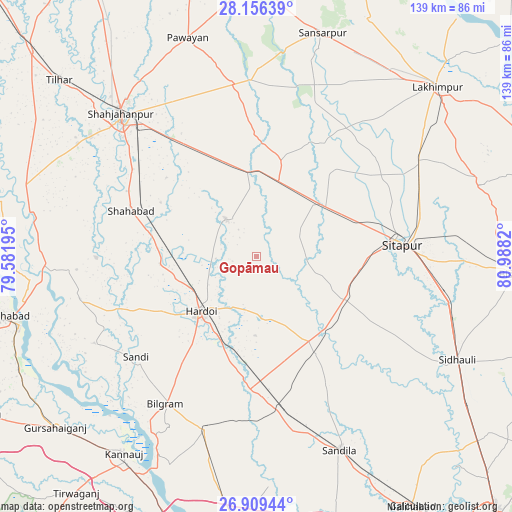
Gopāmau GPS coordinates[2]
27° 32' 4.848" North, 80° 17' 6.252" East
| Map corner | latitude | longitude |
|---|---|---|
| Upper-left | 28.15639°, | 79.58195° |
| Center: | 27.53468°, | 80.28507° |
| Lower-right: | 26.90944°, | 80.9882° |
| Map W x H: | 138.6×138.6 km | = 86.1×86.1mi |
| max Lat: | 34.9274° ⇑17.9% North |
| Gopāmau: | 27.53468° |
| min Lat: | ⇓82.1% South 8.09008° |
| min Long | Gopāmau | max Long |
| 68.82655° | 80.28507° | 96.81° |
| W 70.3%⇐ | ⇒29.7% E |
Elevation
Elevation of Gopāmau is 147 m = 482 ft, and this is 148.6 m = 488 ft below average elevation for this country.
| Max E: |
3681 m = 12077 ft | 60.3% |
| Avg. | 295.6 m = 970 ft | |
| Gopāmau | 147 m = 482 ft | |
Min E: |
1 m = 3 ft | 39.7% |
See also: India elevation on elevation.city.
Geographical zone
Gopāmau is located in North temperate zone (between Tropic of Cancer and the Arctic Circle). Distance of this Northern Tropic circle is 455.7 km =283.2 mi to South.| Distance of | km | miles | from Gopāmau |
|---|---|---|---|
| North Pole | 6945.5 | 4315.7 | to North |
| Arctic Circle | 4339.6 | 2696.5 | to North |
| Tropic Cancer | 455.7 | 283.2 | to South |
| Equator | 3061.6 | 1902.4 | to South |


Nearby cities:
15 places around Gopāmau: (largest is in red/bold)
• Allāhganj
59 km =36.7 mi,  271°
271°
• Benīganj
31.1 km =19.3 mi,  149°
149°
• Bilgrām
47.2 km =29.3 mi,  212°
212°
• Hardoī
21.7 km =13.5 mi,  224°
224°
• Khairābād
46.3 km =28.8 mi,  91°
91°
• Kānt
57.4 km =35.7 mi,  302°
302°
• Maholi
23.5 km =14.6 mi,  52°
52°
• Misrikh
26.9 km =16.7 mi,  115°
115°
• Mādhoganj
48.5 km =30.1 mi,  197°
197°
• Pihānī
12.4 km =7.7 mi,  319°
319°
• Sandīla
56.5 km =35.1 mi,  156°
156°
• Shāhjānpur
53.5 km =33.2 mi, 316°
• Shāhābād
36.1 km =22.4 mi,  289°
289°
• Sāndi
42.8 km =26.6 mi,  230°
230°
• Sītāpur
39.3 km =24.4 mi, 85°
Sources, notices
• [Note1] Compared only with cities in India existing in our database
• [Src1] Map data: © OpenStreetMap contributors (CC-BY-SA)
• [Src2] Other city data from geonames.org with taken over terms of usage.
• [Src3] Geographical zone / Annual Mean Temperature by Robert A. Rohde @ Wikipedia
