Benīganj geodata
Benīganj (Uttar Pradesh) is a populated place; located in India in Asia/Kolkata (GMT+5.5) time zone. With population of 10,418 people, there are 2899 cities with bigger population in this country. Compared to other cities in India, 80.7% of cities are located further ↓South; 70.7% of cities are located further ←West and 61.8% of cities have higher elevation than Benīganj. Note1


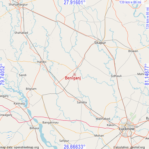
Benīganj GPS coordinates[2]
27° 17' 34.548" North, 80° 26' 37.104" East
| Map corner | latitude | longitude |
|---|---|---|
| Upper-left | 27.91601°, | 79.74052° |
| Center: | 27.29293°, | 80.44364° |
| Lower-right: | 26.66633°, | 81.14677° |
| Map W x H: | 139×139 km | = 86.4×86.4mi |
| max Lat: | 34.9274° ⇑19.3% North |
| Benīganj: | 27.29293° |
| min Lat: | ⇓80.7% South 8.09008° |
| min Long | Benīganj | max Long |
| 68.82655° | 80.44364° | 96.81° |
| W 70.7%⇐ | ⇒29.3% E |
Elevation
Elevation of Benīganj is 139 m = 456 ft, and this is 156.6 m = 514 ft below average elevation for this country.
| Max E: |
3681 m = 12077 ft | 61.8% |
| Avg. | 295.6 m = 970 ft | |
| Benīganj | 139 m = 456 ft | |
Min E: |
1 m = 3 ft | 38.2% |
See also: India elevation on elevation.city.
Geographical zone
Benīganj is located in North temperate zone (between Tropic of Cancer and the Arctic Circle). Distance of this Northern Tropic circle is 428.8 km =266.4 mi to South.| Distance of | km | miles | from Benīganj |
|---|---|---|---|
| North Pole | 6972.4 | 4332.4 | to North |
| Arctic Circle | 4366.5 | 2713.2 | to North |
| Tropic Cancer | 428.8 | 266.4 | to South |
| Equator | 3034.7 | 1885.7 | to South |


Nearby cities:
15 places around Benīganj: (largest is in red/bold)
• Aurās
42.6 km =26.5 mi,  171°
171°
• Bilgrām
42.8 km =26.6 mi,  252°
252°
• Ganj Murādābād
45.3 km =28.1 mi,  214°
214°
• Gopāmau
31.1 km =19.3 mi,  329°
329°
• Hardoī
32.8 km =20.4 mi,  290°
290°
• Khairābād
40.2 km =25 mi,  49°
49°
• Maholi
41.3 km =25.7 mi,  4°
4°
• Malīhābād
49 km =30.4 mi,  147°
147°
• Misrikh
17.7 km =11 mi,  29°
29°
• Mādhoganj
35.7 km =22.2 mi,  237°
237°
• Pihānī
43.4 km =27 mi, 326°
• Sandīla
25.8 km =16 mi,  164°
164°
• Sidhaulī
38.6 km =24 mi,  91°
91°
• Sāndi
48.6 km =30.2 mi,  269°
269°
• Sītāpur
38.1 km =23.7 mi,  38°
38°
Sources, notices
• [Note1] Compared only with cities in India existing in our database
• [Src1] Map data: © OpenStreetMap contributors (CC-BY-SA)
• [Src2] Other city data from geonames.org with taken over terms of usage.
• [Src3] Geographical zone / Annual Mean Temperature by Robert A. Rohde @ Wikipedia
