Mādhoganj geodata
Mādhoganj (Uttar Pradesh) is a populated place; located in India in Asia/Kolkata (GMT+5.5) time zone. With population of 10,299 people, there are 2911 cities with bigger population in this country. Compared to other cities in India, 79.4% of cities are located further ↓South; 68.9% of cities are located further ←West and 61.1% of cities have higher elevation than Mādhoganj. Note1


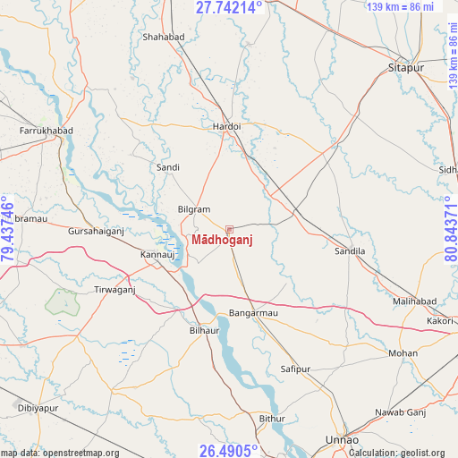
Mādhoganj GPS coordinates[2]
27° 7' 5.052" North, 80° 8' 26.088" East
| Map corner | latitude | longitude |
|---|---|---|
| Upper-left | 27.74214°, | 79.43746° |
| Center: | 27.11807°, | 80.14058° |
| Lower-right: | 26.4905°, | 80.84371° |
| Map W x H: | 139.2×139.2 km | = 86.5×86.5mi |
| max Lat: | 34.9274° ⇑20.6% North |
| Mādhoganj: | 27.11807° |
| min Lat: | ⇓79.4% South 8.09008° |
| min Long | Mādhoganj | max Long |
| 68.82655° | 80.14058° | 96.81° |
| W 68.9%⇐ | ⇒31.1% E |
Elevation
Elevation of Mādhoganj is 142 m = 466 ft, and this is 153.6 m = 504 ft below average elevation for this country.
| Max E: |
3681 m = 12077 ft | 61.1% |
| Avg. | 295.6 m = 970 ft | |
| Mādhoganj | 142 m = 466 ft | |
Min E: |
1 m = 3 ft | 38.9% |
See also: India elevation on elevation.city.
Geographical zone
Mādhoganj is located in North temperate zone (between Tropic of Cancer and the Arctic Circle). Distance of this Northern Tropic circle is 409.3 km =254.3 mi to South.| Distance of | km | miles | from Mādhoganj |
|---|---|---|---|
| North Pole | 6991.8 | 4344.5 | to North |
| Arctic Circle | 4385.9 | 2725.3 | to North |
| Tropic Cancer | 409.3 | 254.3 | to South |
| Equator | 3015.2 | 1873.6 | to South |


Nearby cities:
15 places around Mādhoganj: (largest is in red/bold)
• Aurās
42.9 km =26.7 mi,  121°
121°
• Benīganj
35.7 km =22.2 mi,  57°
57°
• Bilgrām
12.5 km =7.8 mi,  300°
300°
• Bilhaur
31.5 km =19.6 mi,  193°
193°
• Bāngarmau
26.2 km =16.3 mi,  164°
164°
• Fatehpur Chaurāsi
38.6 km =24 mi, 161°
• Ganj Murādābād
18.4 km =11.4 mi,  166°
166°
• Gopāmau
48.5 km =30.1 mi,  17°
17°
• Gursahāiganj
40.5 km =25.2 mi,  269°
269°
• Hardoī
30.8 km =19.1 mi,  358°
358°
• Kannauj
23 km =14.3 mi,  252°
252°
• Safīpur
46.8 km =29.1 mi,  154°
154°
• Sandīla
37.4 km =23.2 mi,  98°
98°
• Sāndi
26.6 km =16.5 mi,  315°
315°
• Ugu
39.9 km =24.8 mi, 153°
Sources, notices
• [Note1] Compared only with cities in India existing in our database
• [Src1] Map data: © OpenStreetMap contributors (CC-BY-SA)
• [Src2] Other city data from geonames.org with taken over terms of usage.
• [Src3] Geographical zone / Annual Mean Temperature by Robert A. Rohde @ Wikipedia
