Dera Gopipur geodata
Dera Gopipur (Himachal Pradesh) is a populated place; located in India in Asia/Kolkata (GMT+5.5) time zone. With population of 4,735 people, there are 3351 cities with bigger population in this country. Compared to other cities in India, 97.7% of cities are located further ↓South; 71.5% of cities are located further →East and 79% of cities have lower elevation than Dera Gopipur. Note1


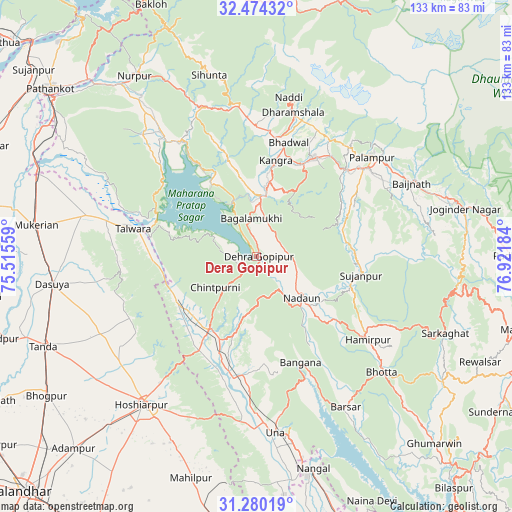
Dera Gopipur GPS coordinates[2]
31° 52' 45.084" North, 76° 13' 7.356" East
| Map corner | latitude | longitude |
|---|---|---|
| Upper-left | 32.47432°, | 75.51559° |
| Center: | 31.87919°, | 76.21871° |
| Lower-right: | 31.28019°, | 76.92184° |
| Map W x H: | 132.8×132.8 km | = 82.5×82.5mi |
| max Lat: | 34.9274° ⇑2.3% North |
| Dera Gopipur: | 31.87919° |
| min Lat: | ⇓97.7% South 8.09008° |
| min Long | Dera Gopipur | max Long |
| 68.82655° | 76.21871° | 96.81° |
| W 28.5%⇐ | ⇒71.5% E |
Elevation
Elevation of Dera Gopipur is 445 m = 1460 ft, and this is 149.4 m = 490 ft above average elevation for this country.
| Max E: |
3681 m = 12077 ft | 21% |
| Dera Gopipur | 445 m 1460 ft | |
| Avg. | 295.6 m = 970 ft | |
Min E: |
1 m = 3 ft | 79% |
See also: India elevation on elevation.city.
Geographical zone
Dera Gopipur is located in North temperate zone (between Tropic of Cancer and the Arctic Circle). Distance of this Northern Tropic circle is 938.7 km =583.3 mi to South.| Distance of | km | miles | from Dera Gopipur |
|---|---|---|---|
| North Pole | 6462.4 | 4015.5 | to North |
| Arctic Circle | 3856.5 | 2396.3 | to North |
| Tropic Cancer | 938.7 | 583.3 | to South |
| Equator | 3544.6 | 2202.5 | to South |


Nearby cities:
15 places around Dera Gopipur: (largest is in red/bold)
• Daulatpur
20.1 km =12.5 mi,  11°
11°
• Daulatpur
23.7 km =14.7 mi,  244°
244°
• Dharamsala
39.1 km =24.3 mi, 14°
• Gagret
28.7 km =17.8 mi,  211°
211°
• Hamīrpur
36.2 km =22.5 mi,  126°
126°
• Hariāna
45 km =28 mi,  232°
232°
• Jawāla Mukhi
9.6 km =6 mi,  93°
93°
• Kotla
44.8 km =27.8 mi,  337°
337°
• Kāngar
24 km =14.9 mi, 9°
• Nagrota
23.1 km =14.4 mi,  328°
328°
• Nādaun
15.9 km =9.9 mi, 132°
• Pālampur
41.2 km =25.6 mi,  50°
50°
• Talwāra
32 km =19.9 mi,  281°
281°
• Tīra Sujānpur
27.5 km =17.1 mi,  100°
100°
• Yol
31.8 km =19.8 mi,  356°
356°
Sources, notices
• [Note1] Compared only with cities in India existing in our database
• [Src1] Map data: © OpenStreetMap contributors (CC-BY-SA)
• [Src2] Other city data from geonames.org with taken over terms of usage.
• [Src3] Geographical zone / Annual Mean Temperature by Robert A. Rohde @ Wikipedia
